

The best hiking routes in Rio Paiva
Discover the best walks in Rio Paiva. 7 routes on the map, with descriptions, photos and GPX.
Managed by Instituto da Conservação da Natureza e das Florestas
About Rio Paiva
The Rio Paiva flows through a steep, rocky valley in northern Portugal, characterized by dramatic granite gorges, fast-flowing rapids, and Mediterranean scrub. Unlike flatter river basins, this corridor is defined by its sheer verticality, where narrow footpaths and wooden boardwalks cling directly to the cliff faces. The landscape is a mix of exposed grey stone, hardy shrubs, and pockets of riparian forest that thrive near the water level. It is a highly structured environment where walkers are largely confined to the designated pathways due to the precipitous terrain.
Read more
About Rio Paiva
The Rio Paiva flows through a steep, rocky valley in northern Portugal, characterized by dramatic granite gorges, fast-flowing rapids, and Mediterranean scrub. Unlike flatter river basins, this corridor is defined by its sheer verticality, where narrow footpaths and wooden boardwalks cling directly to the cliff faces. The landscape is a mix of exposed grey stone, hardy shrubs, and pockets of riparian forest that thrive near the water level. It is a highly structured environment where walkers are largely confined to the designated pathways due to the precipitous terrain.
Read moreThe Rio Paiva flows through a steep, rocky valley in northern Portugal, characterized by dramatic granite gorges, fast-flowing rapids, and Mediterranean scrub. Unlike flatter river basins, this corridor is defined by its sheer verticality, where narrow footpaths and wooden boardwalks cling directly to the cliff faces. The landscape is a mix of exposed grey stone, hardy shrubs, and pockets of riparian forest that thrive near the water level. It is a highly structured environment where walkers are largely confined to the designated pathways due to the precipitous terrain.
Underfoot, the experience is divided between the engineered wooden planks of the Passadiços do Paiva and rugged, uneven dirt tracks that climb the valley sides. The boardwalks provide a level, elevated surface over the most turbulent sections of the river, while the natural trails require navigating loose stones, exposed tree roots, and steep stone steps. In the drier months of July and August, the surrounding hillsides appear arid and sun-baked, contrasting sharply with the deep, shaded pools of the riverbed below.
This area is not a wilderness for solitary exploration, as the famous wooden walkways draw regular foot traffic, particularly on weekends. Walkers should expect a managed natural environment with controlled entry points rather than an open, signpost-free forest. The appeal lies in the close-up view of the river's erosive power on the granite bedrock, visible from the safety of the built infrastructure.
Hiking routes in Rio Paiva (7)

#1. Estação da Biodiversidade de Lamosa

#2. Fornos

#3. Grande Rota da Transumância
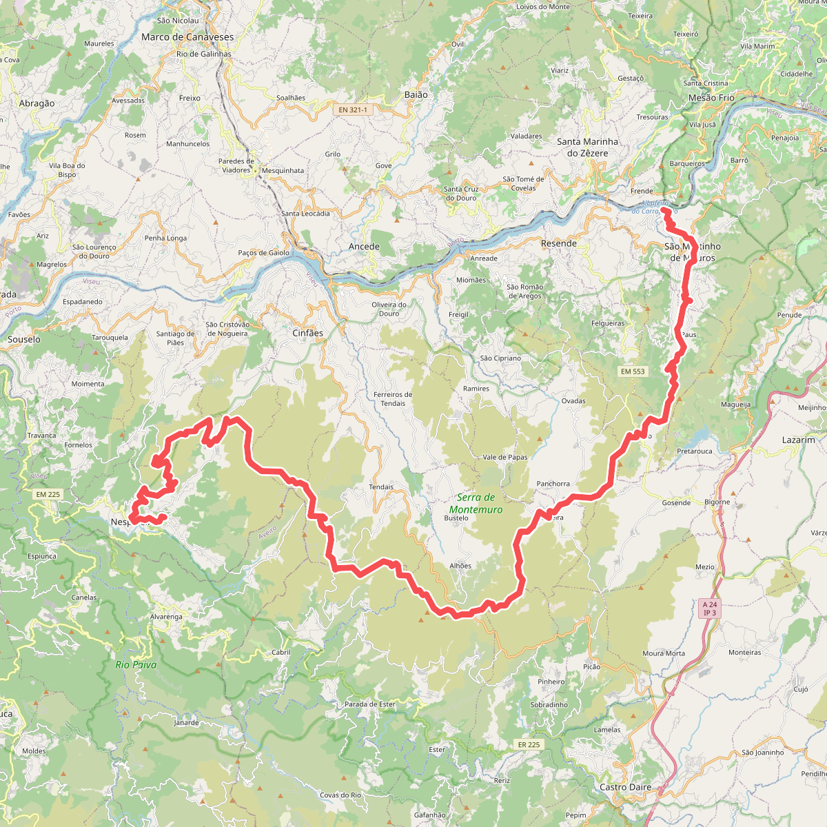
#4. Grande Rota do Montemuro

#5. Passadiços do Paiva

#6. Real





