

The best hiking routes in Natura 2000 du Massif de Rambouillet et Zones Humides Proches
Discover the best walks in Natura 2000 du Massif de Rambouillet et Zones Humides Proches. 26 routes on the map, with descriptions, photos and GPX.
About Natura 2000 du Massif de Rambouillet et Zones Humides Proches
The Natura 2000 du Massif de Rambouillet et Zones Humides Proches offers a landscape shaped by its underlying geology of clay and sand, creating a distinct contrast between dry, sandy oak-pine forests and waterlogged depressions. Unlike typical managed forests, this protected area is defined by its extensive network of ponds, marshes, and peat bogs. Walkers will notice how the terrain shifts abruptly from firm, sandy tracks under tall canopy to damp, mossy ground where birch and alder thrive in the wetter soils.
Read more
About Natura 2000 du Massif de Rambouillet et Zones Humides Proches
The Natura 2000 du Massif de Rambouillet et Zones Humides Proches offers a landscape shaped by its underlying geology of clay and sand, creating a distinct contrast between dry, sandy oak-pine forests and waterlogged depressions. Unlike typical managed forests, this protected area is defined by its extensive network of ponds, marshes, and peat bogs. Walkers will notice how the terrain shifts abruptly from firm, sandy tracks under tall canopy to damp, mossy ground where birch and alder thrive in the wetter soils.
Read moreThe Natura 2000 du Massif de Rambouillet et Zones Humides Proches offers a landscape shaped by its underlying geology of clay and sand, creating a distinct contrast between dry, sandy oak-pine forests and waterlogged depressions. Unlike typical managed forests, this protected area is defined by its extensive network of ponds, marshes, and peat bogs. Walkers will notice how the terrain shifts abruptly from firm, sandy tracks under tall canopy to damp, mossy ground where birch and alder thrive in the wetter soils.
Underfoot, the paths vary from soft sand that can feel heavy to walk on, to damp earth and occasional wooden boardwalks designed to protect the fragile wetland vegetation. The area is flat to gently undulating, lacking any steep climbs or dramatic viewpoints, offering instead a quiet, enclosed woodland experience. In late summer, particularly around August, the purple heather blooms in the clearer sandy glades, while the marshy zones remain green and dense with ferns.
This is a working forest environment where forestry tracks intersect with narrow walking trails. While the main paths near the historic ponds can attract more visitors on weekends, the deeper wetland zones and quieter oak stands remain peaceful. It is a place for observing subtle changes in forest ecology rather than seeking wide-open horizons.
Hiking routes in Natura 2000 du Massif de Rambouillet et Zones Humides Proches (26)

#1. 19

#2. Aigrefoin

#3. Boucle Villier, les Rigoles, Tête Ronde

#4. Château de Dampierre et marais de Maincourt

#5. Chemin de Trèves, Igny - Rambouillet

#6. Chemin Jean Racine

#7. De Epernon à Richebourg

#8. Du Val d'Yerres à l'Étampois
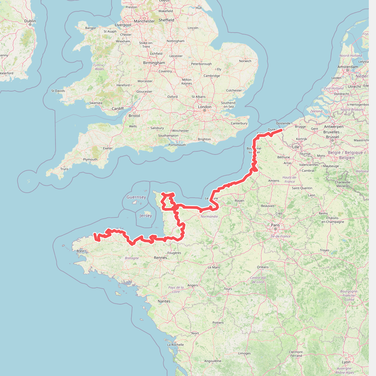
#9. Eurovelo 4
Roscoff,Saint-Pol-de-Léon,Plouénan,Taulé,Saint-Martin-des-Champs,Morlaix,Plouezoc'h,Plougasnou,Saint-Jean-du-Doigt,Guimaëc,Locquirec,Plestin-les-Grèves,Saint-Michel-en-Grève,Ploumilliau,Ploubezre,Lannion,Trébeurden,Pleumeur-Bodou,Trégastel,Perros-Guirec,Louannec,Camlez,Penvénan,Plouguiel,Trédarzec,Pleumeur-Gautier,Lézardrieux,Paimpol,Plouézec,Plouha,Tréveneuc,Binic-Étables-sur-Mer,Pordic,Plérin,Saint-Brieuc,Langueux,Hillion,Lamballe-Armor,Pléneuf-Val-André,Erquy,Fréhel,Plévenon,Pléboulle,Matignon,Saint-Cast-le-Guildo,Beaussais-sur-Mer,Tréméreuc,Plouër-sur-Rance,Saint-Suliac,Saint-Père-Marc-en-Poulet,Saint-Malo,Saint-Coulomb,Cancale,Saint-Méloir-des-Ondes,Hirel,Cherrueix,France métropolitaine,Roz-sur-Couesnon,Pontorson,Courtils,Céaux,Poilley,Ducey-les-Chéris,Isigny-le-Buat,Grandparigny,Romagny Fontenay,Saint-Clément-Rancoudray,Sourdeval,Vire Normandie,Souleuvre-en-Bocage,Pont-Bellanger,Tessy-Bocage,Fourneaux,Condé-sur-Vire,Bourgvallées,Saint-Lô,Agneaux,Pont-Hébert,Airel

#10. Girouard, l'intimité d'une vallée escarpée

#11. Grand Tour de Paris, variante par Bonnelles





