

The best hiking routes in Parc naturel régional des Caps et marais d'Opale
Discover the best walks in Parc naturel régional des Caps et marais d'Opale. 2 routes on the map, with descriptions, photos and GPX.
About Parc naturel régional des Caps et marais d'Opale
Parc naturel régional des Caps et marais d'Opale presents two distinct walking landscapes divided by a limestone cuesta. In the western coastal strip, the terrain is defined by dramatic chalk cliffs like Cap Blanc-Nez and Cap Gris-Nez, where paths run along exposed clifftops and down into steep dry valleys called crans. Underfoot, you will find a mix of hard-packed chalk, clay, and coastal turf. The inland section contrasts sharply, dominated by the Audomarois marshes, a flat labyrinth of wet fields and drainage canals where walking relies on low towpaths and occasional wooden footbridges.
Read more
About Parc naturel régional des Caps et marais d'Opale
Parc naturel régional des Caps et marais d'Opale presents two distinct walking landscapes divided by a limestone cuesta. In the western coastal strip, the terrain is defined by dramatic chalk cliffs like Cap Blanc-Nez and Cap Gris-Nez, where paths run along exposed clifftops and down into steep dry valleys called crans. Underfoot, you will find a mix of hard-packed chalk, clay, and coastal turf. The inland section contrasts sharply, dominated by the Audomarois marshes, a flat labyrinth of wet fields and drainage canals where walking relies on low towpaths and occasional wooden footbridges.
Read moreParc naturel régional des Caps et marais d'Opale presents two distinct walking landscapes divided by a limestone cuesta. In the western coastal strip, the terrain is defined by dramatic chalk cliffs like Cap Blanc-Nez and Cap Gris-Nez, where paths run along exposed clifftops and down into steep dry valleys called crans. Underfoot, you will find a mix of hard-packed chalk, clay, and coastal turf. The inland section contrasts sharply, dominated by the Audomarois marshes, a flat labyrinth of wet fields and drainage canals where walking relies on low towpaths and occasional wooden footbridges.
Between these two extremes lies the Boulonnais bocage, a gently rolling landscape of clay soil, thick hedgerows, and small deciduous woodlands like the Forêt de Guînes. Here, the paths are often ancient sunken lanes, hemmed in by earth banks and hazel trees. The transition from the chalky downs to these damp, clay-heavy valleys is sudden, marked by a change from short, sheep-grazed grass to lush pastures and orchards.
This is not a region of high peaks or deep gorges, but rather one of gentle elevation changes and varied terrain. While the coastal paths can be busy near the main capes, the interior bocage and the quiet canal banks near Saint-Omer offer a much slower pace. In May, the woodland floors of the interior forests are covered in wild garlic, while the chalk grasslands of the hillsides show their first orchids.
Hiking routes in Parc naturel régional des Caps et marais d'Opale (2)
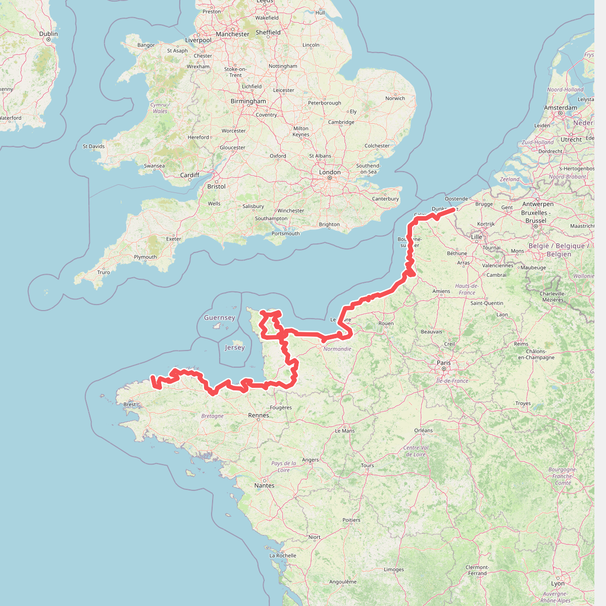
#1. Eurovelo 4
Roscoff,Saint-Pol-de-Léon,Plouénan,Taulé,Saint-Martin-des-Champs,Morlaix,Plouezoc'h,Plougasnou,Saint-Jean-du-Doigt,Guimaëc,Locquirec,Plestin-les-Grèves,Saint-Michel-en-Grève,Ploumilliau,Ploubezre,Lannion,Trébeurden,Pleumeur-Bodou,Trégastel,Perros-Guirec,Louannec,Camlez,Penvénan,Plouguiel,Trédarzec,Pleumeur-Gautier,Lézardrieux,Paimpol,Plouézec,Plouha,Tréveneuc,Binic-Étables-sur-Mer,Pordic,Plérin,Saint-Brieuc,Langueux,Hillion,Lamballe-Armor,Pléneuf-Val-André,Erquy,Fréhel,Plévenon,Pléboulle,Matignon,Saint-Cast-le-Guildo,Beaussais-sur-Mer,Tréméreuc,Plouër-sur-Rance,Saint-Suliac,Saint-Père-Marc-en-Poulet,Saint-Malo,Saint-Coulomb,Cancale,Saint-Méloir-des-Ondes,Hirel,Cherrueix,France métropolitaine,Roz-sur-Couesnon,Pontorson,Courtils,Céaux,Poilley,Ducey-les-Chéris,Isigny-le-Buat,Grandparigny,Romagny Fontenay,Saint-Clément-Rancoudray,Sourdeval,Vire Normandie,Souleuvre-en-Bocage,Pont-Bellanger,Tessy-Bocage,Fourneaux,Condé-sur-Vire,Bourgvallées,Saint-Lô,Agneaux,Pont-Hébert,Airel





