

The best hiking routes in chráněná krajinná oblast Kokořínsko - Máchův kraj
Discover the best walks in chráněná krajinná oblast Kokořínsko - Máchův kraj. 37 routes on the map, with descriptions, photos and GPX.
About chráněná krajinná oblast Kokořínsko - Máchův kraj
Chráněná krajinná oblast Kokořínsko - Máchův kraj is defined by two distinct landscape types. In the southern Kokořínsko section, you walk through deep sandstone canyons where vertical rock towers rise directly from the damp valley floors. The paths here are often shaded by dense pine and beech forests, with sandy tracks underfoot that can make walking slow. In contrast, the northern Máchův kraj section opens up around the large fishpond of Máchovo jezero, featuring flatter pine barrens, peat bogs, and wet wetlands where wooden boardwalks keep you above the damp ground.
Read more
About chráněná krajinná oblast Kokořínsko - Máchův kraj
Chráněná krajinná oblast Kokořínsko - Máchův kraj is defined by two distinct landscape types. In the southern Kokořínsko section, you walk through deep sandstone canyons where vertical rock towers rise directly from the damp valley floors. The paths here are often shaded by dense pine and beech forests, with sandy tracks underfoot that can make walking slow. In contrast, the northern Máchův kraj section opens up around the large fishpond of Máchovo jezero, featuring flatter pine barrens, peat bogs, and wet wetlands where wooden boardwalks keep you above the damp ground.
Read moreChráněná krajinná oblast Kokořínsko - Máchův kraj is defined by two distinct landscape types. In the southern Kokořínsko section, you walk through deep sandstone canyons where vertical rock towers rise directly from the damp valley floors. The paths here are often shaded by dense pine and beech forests, with sandy tracks underfoot that can make walking slow. In contrast, the northern Máchův kraj section opens up around the large fishpond of Máchovo jezero, featuring flatter pine barrens, peat bogs, and wet wetlands where wooden boardwalks keep you above the damp ground.
This landscape is shaped by the erosion of soft Cretaceous sandstone. On the trail, you will notice how the rock formations have weathered into honeycomb structures, overhangs, and narrow gorges that trap cool air even in mid-summer. The transition from dry, pine-covered sand dunes to waterlogged peat depressions happens abruptly, requiring a mix of firm forest paths and soft sand walking. There are no high mountain peaks or long-distance views over mountain ranges; the terrain is a maze of rocky corridors and low, wooded hills.
While popular spots near the castle ruins of Bezděz and the main lake shores draw crowds in July and August, the deeper sandstone ravines and the quieter peat bogs remain peaceful. The area is ideal for those who prefer navigating rocky labyrinths and level pine forests rather than climbing steep elevation gains.
Hiking routes in chráněná krajinná oblast Kokořínsko - Máchův kraj (37)

#1. [Č] Česká Lípa - Doksy
Doksy,Chlum,Jestřebí,Zahrádky,Kvítkov,Sosnová,Česká Lípa

#2. [Č] Debř - Kokořín
Mladá Boleslav,Hrdlořezy,Čistá,Bělá pod Bezdězem,Bezděz,Doksy,Blatce

#3. [Č] Dubá - Holany
Holany,Blíževedly,Dubá,Tuhaň,Medonosy

#4. [Č] Holany - Ploskovice
Úštěk,Blíževedly,Stvolínky,Holany

#5. [Č] Jestřebice - Klemperka
Dobřeň,Kokořín

#6. [Č] Máchova cesta
Blatce,Mšeno,Kokořín,Kanina,Vysoká,Nebužely,Střemy,Lhotka,Mělník

#7. [Č] Mšeno (žst) - U Grobiána
Mšeno,Kokořín

#8. Dubský okruh
Dubá
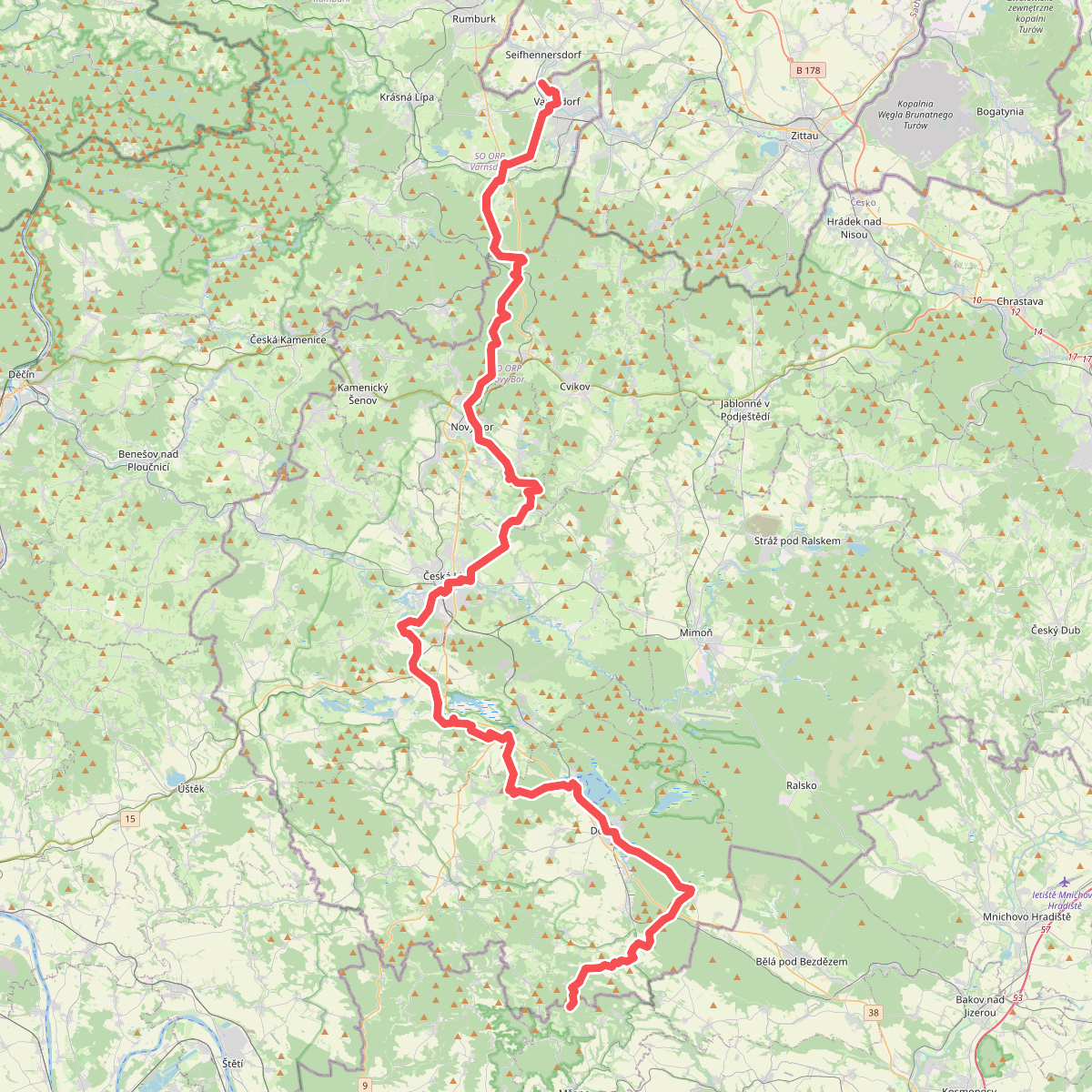
#9. Evropská dálková trasa E10, Česká republika, Severočeský kraj

#10. Evropská dálková trasa E10, Česká republika, Středočeský kraj a Praha

#11. [M] Česká Lípa - Debř
Mladá Boleslav,Hrdlořezy,Bukovno,Čistá,Plužná,Bělá pod Bezdězem,Březovice,Bezděz,Ralsko,Doksy,Jestřebí,Provodín,Česká Lípa

#12. [M] Holany- Česká Lípa
Holany,Zahrádky,Kvítkov,Česká Lípa




