

The best hiking routes in CHKO Železné hory
Discover the best walks in CHKO Železné hory. 6 routes on the map, with descriptions, photos and GPX.
About CHKO Železné hory
CHKO Źelezn hory presents a landscape shaped by a dramatic geological fault line, resulting in a distinct transition between a flat plateau and steep, rocky ravines. Walkers will notice how the terrain splits: the northern edge drops sharply into the lowland plains, while the interior consists of gently undulating hills, dense beech forests, and quiet agricultural fields. This is not a region of high alpine peaks or deep mountain passes, but rather a patchwork of rocky outcrops, small streams, and old stone quarries that reveal the area's complex geological history directly along the paths.
Read more
About CHKO Železné hory
CHKO Źelezn hory presents a landscape shaped by a dramatic geological fault line, resulting in a distinct transition between a flat plateau and steep, rocky ravines. Walkers will notice how the terrain splits: the northern edge drops sharply into the lowland plains, while the interior consists of gently undulating hills, dense beech forests, and quiet agricultural fields. This is not a region of high alpine peaks or deep mountain passes, but rather a patchwork of rocky outcrops, small streams, and old stone quarries that reveal the area's complex geological history directly along the paths.
Read moreCHKO Źelezn hory presents a landscape shaped by a dramatic geological fault line, resulting in a distinct transition between a flat plateau and steep, rocky ravines. Walkers will notice how the terrain splits: the northern edge drops sharply into the lowland plains, while the interior consists of gently undulating hills, dense beech forests, and quiet agricultural fields. This is not a region of high alpine peaks or deep mountain passes, but rather a patchwork of rocky outcrops, small streams, and old stone quarries that reveal the area's complex geological history directly along the paths.
Underfoot, the trails vary from soft forest loam and needle-covered paths to rugged, stony tracks where the underlying granite and slate break through the surface. In the deeper gorges, such as those carved by the Chrudimka river, the paths can be damp and mossy, requiring careful stepping over wet stones and exposed tree roots. On the higher plateau, the tracks open up into wider, sandy dirt roads that run between fields and small villages, offering straightforward walking with gradual elevation changes.
While well-known spots like the ruins of Lichnice or the reservoir banks can attract more visitors on weekends, much of the forested interior remains quiet. In late October, the extensive beech woodlands turn a deep copper color, making this the most visually striking time to explore the ravines. Walkers should expect a rustic, working landscape where forestry tracks and quiet local roads connect the pockets of protected woodland, woodland, rather than an untouched wilderness.
Hiking routes in CHKO Železné hory (6)
![[Č] Chřenovice - Přibyslav](https://wandelweb.fsn1.your-objectstorage.com/tracks/static-maps/35520-1779134266-large.png)
#1. [Č] Chřenovice - Přibyslav
Chřenovice,Ledeč nad Sázavou,Bojiště,Trpišovice,Světlá nad Sázavou,Nová Ves u Světlé,Pohleď,Okrouhlice,Havlíčkův Brod,Pohled,Stříbrné Hory,Přibyslav
![[Č] Podhradí - Horní Bradlo](https://wandelweb.fsn1.your-objectstorage.com/tracks/static-maps/35947-1779134439-large.png)
#2. [Č] Podhradí - Horní Bradlo
Třemošnice,Míčov-Sušice,Žlebské Chvalovice,Ronov nad Doubravou,Žleby
![[M] Chotěboř - Javorka](https://wandelweb.fsn1.your-objectstorage.com/tracks/static-maps/35699-1779134328-large.png)
#3. [M] Chotěboř - Javorka
Chotěboř,Nová Ves u Chotěboře,Uhelná Příbram,Vilémov,Kraborovice,Běstvina,Seč
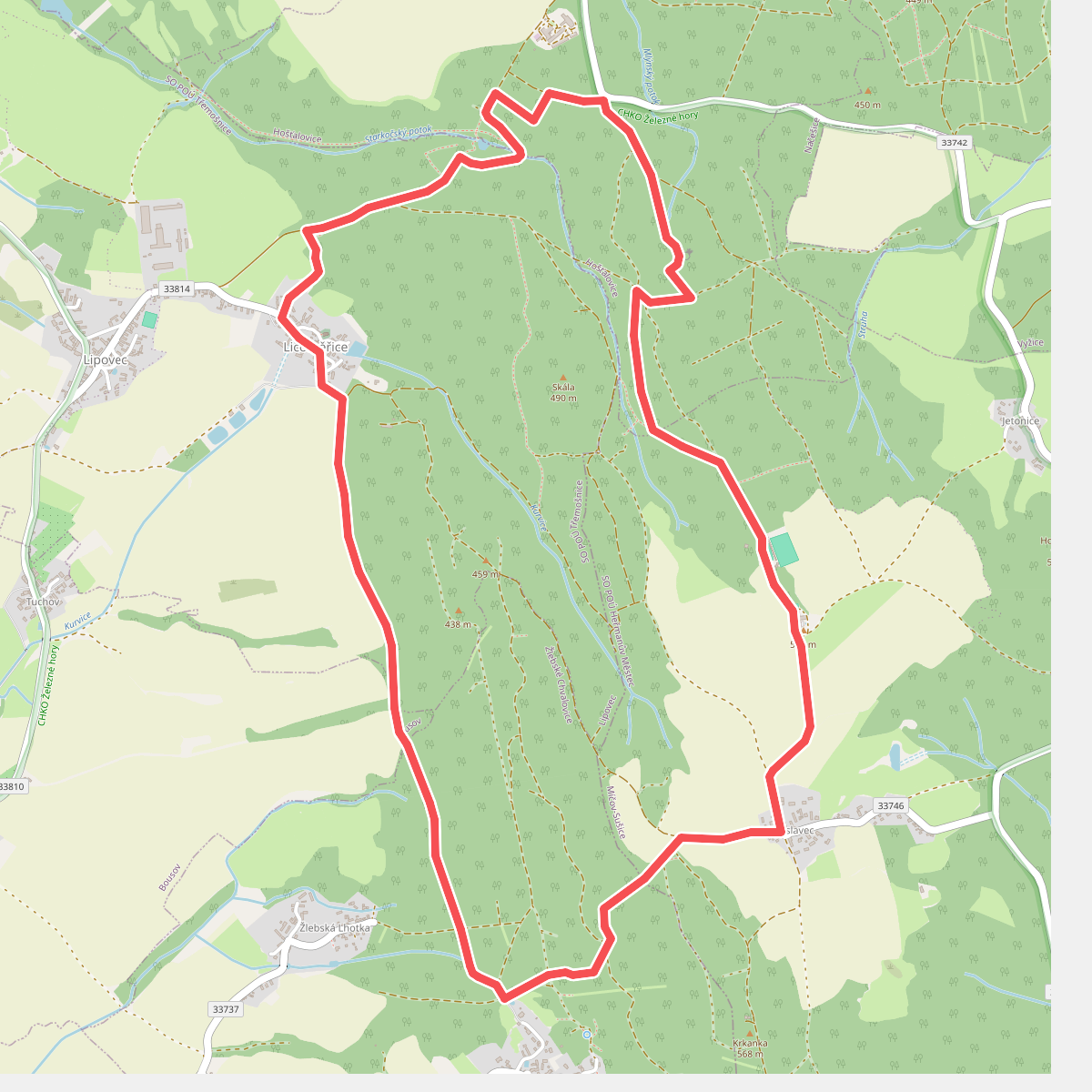
#4. Partyzánská stezka
Žlebské Chvalovice,Lipovec,Hošťalovice,Míčov-Sušice
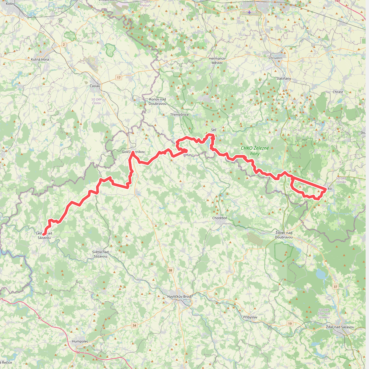
#5. Via Czechia - Centrální (6. Hornosázavská pahorkatina a Železné hory)
![[Z] Ronov nad Doubravou - Pod Luhy](https://wandelweb.fsn1.your-objectstorage.com/tracks/static-maps/35952-1779134437-large.png)
#6. [Z] Ronov nad Doubravou - Pod Luhy
Ronov nad Doubravou



