
Comblain-au-Pont
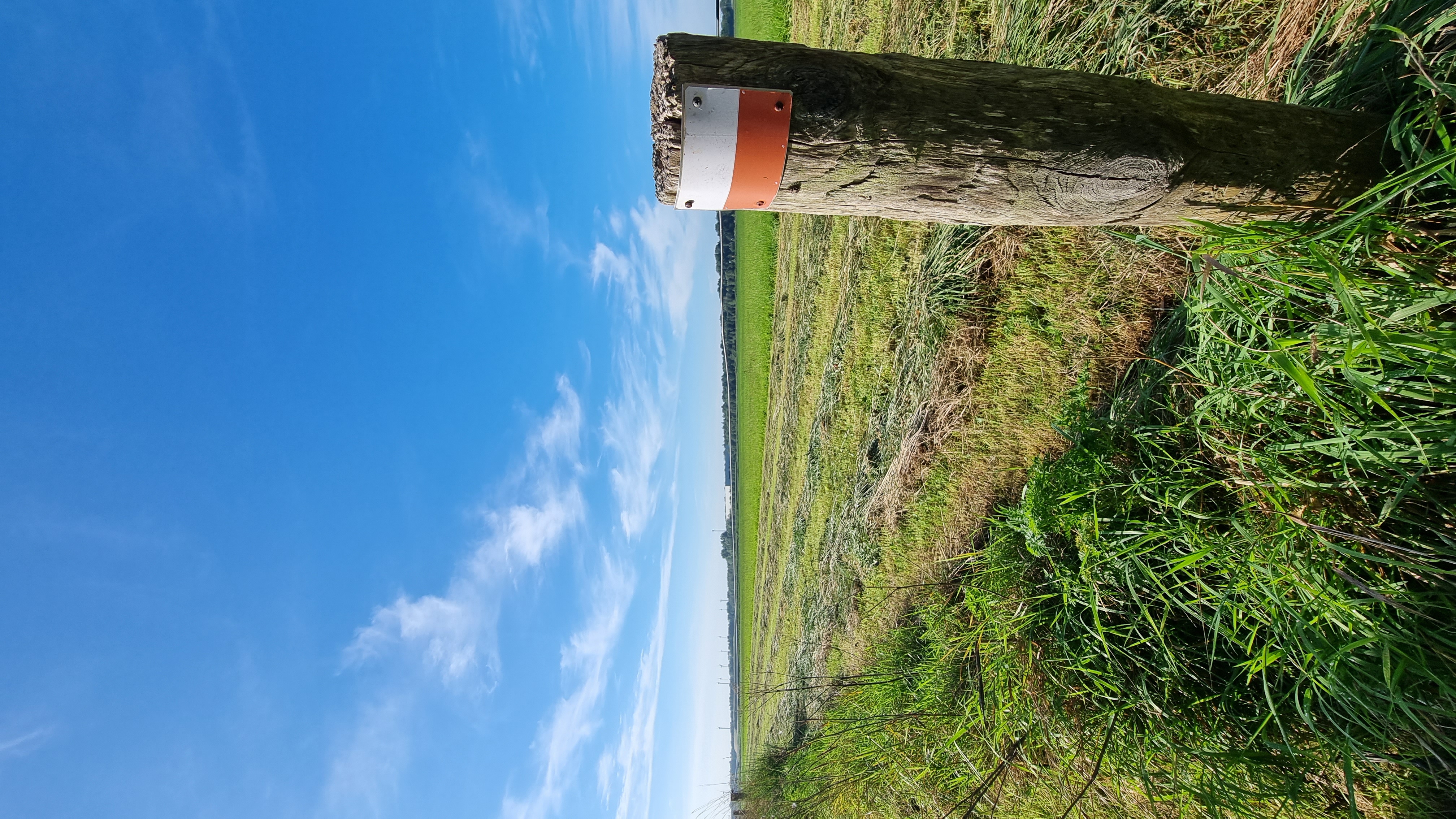
Ontdek de mooiste wandelroutes in en rond Comblain-au-Pont
Routes per categorie
🏆 Best beoordeelde routes
Alle routes bij Comblain-au-Pont
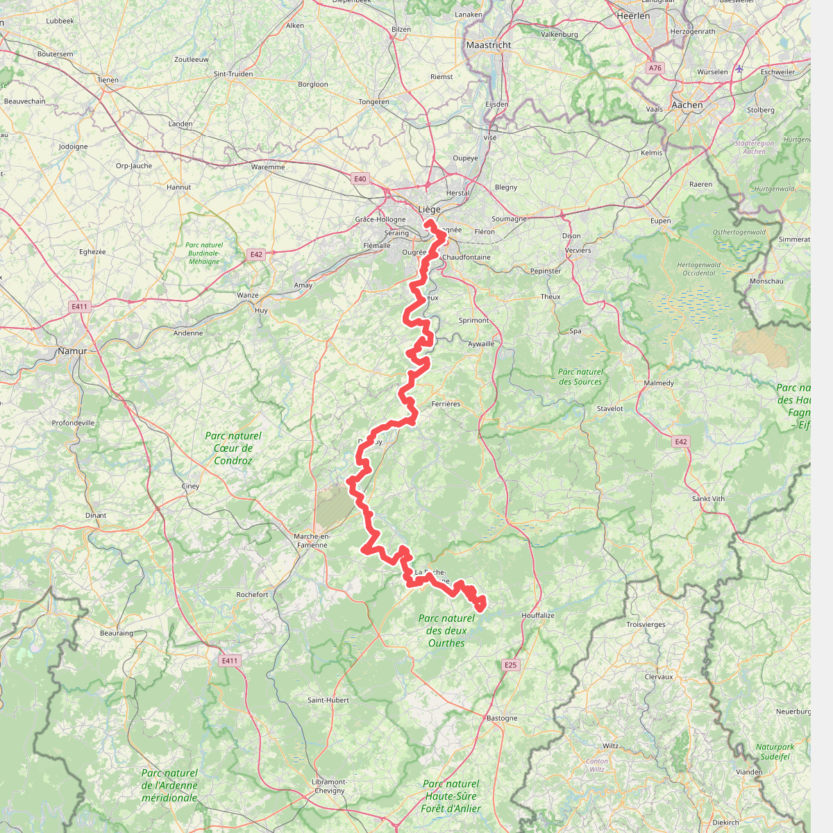
Gr57
Liège,Esneux,Neupré,Anthisnes,Comblain-au-Pont,Hamoir,Durbuy,Hotton,Rendeux,Marche-en-Famenne,Hodister,Marcourt,Halleux,Beausaint,La Roche-en-Ardenne,Ortho,Samrée,Nadrin
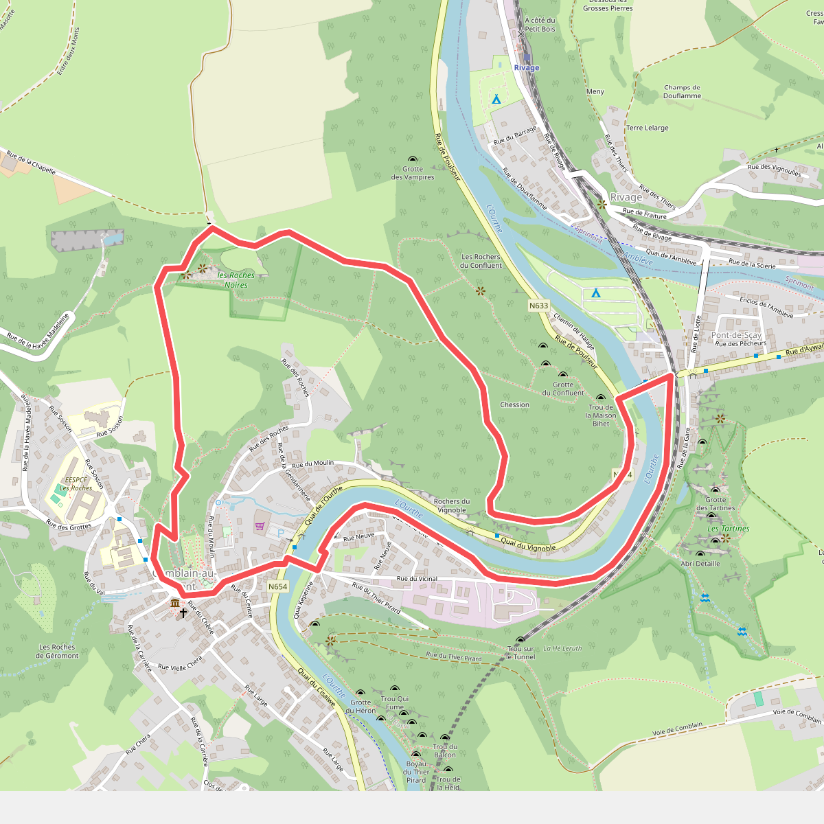
CB01 Saint Martin - Roches Noires - Chession - Pic Napoléon
Comblain-au-Pont
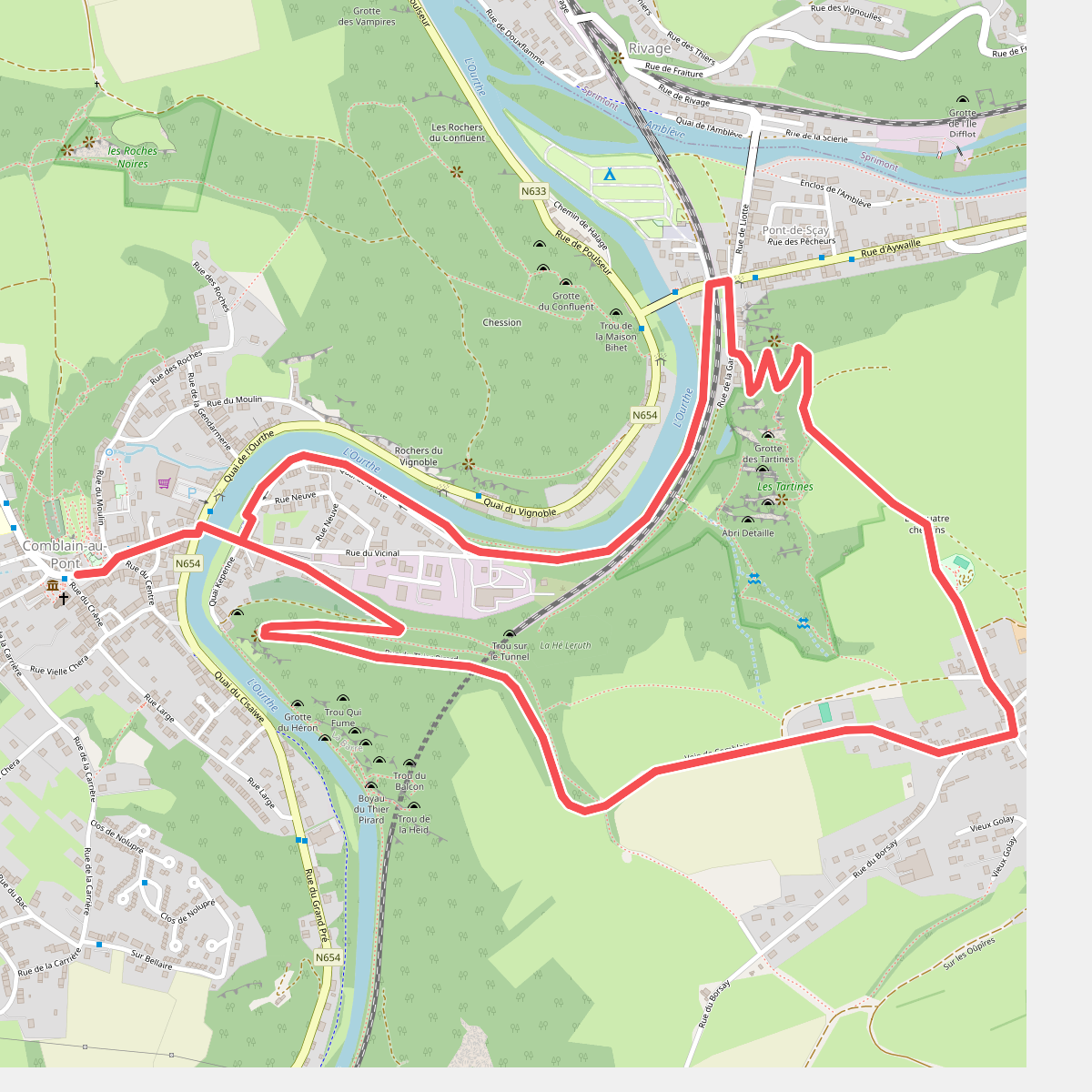
CB02 Thier Pirard - Oneux - Tartines
Comblain-au-Pont
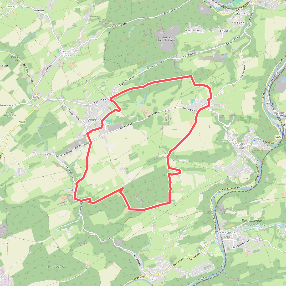
AS03 Boucle de Tolumont
Anthisnes,Comblain-au-Pont
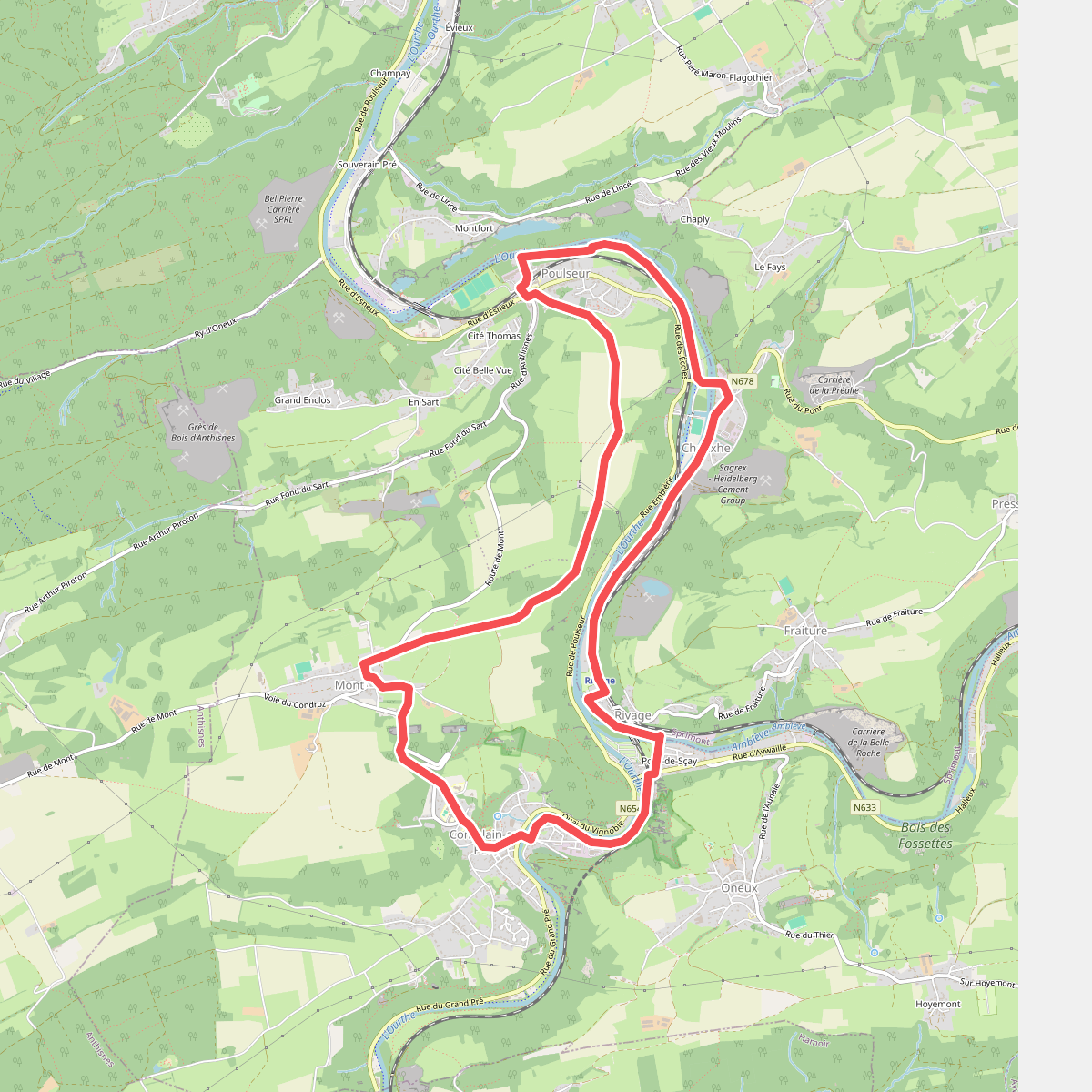
CB03 Four à Chaux - Mont - Poulseur - Canal de l'Ourthe - Rivage
Comblain-au-Pont,Sprimont
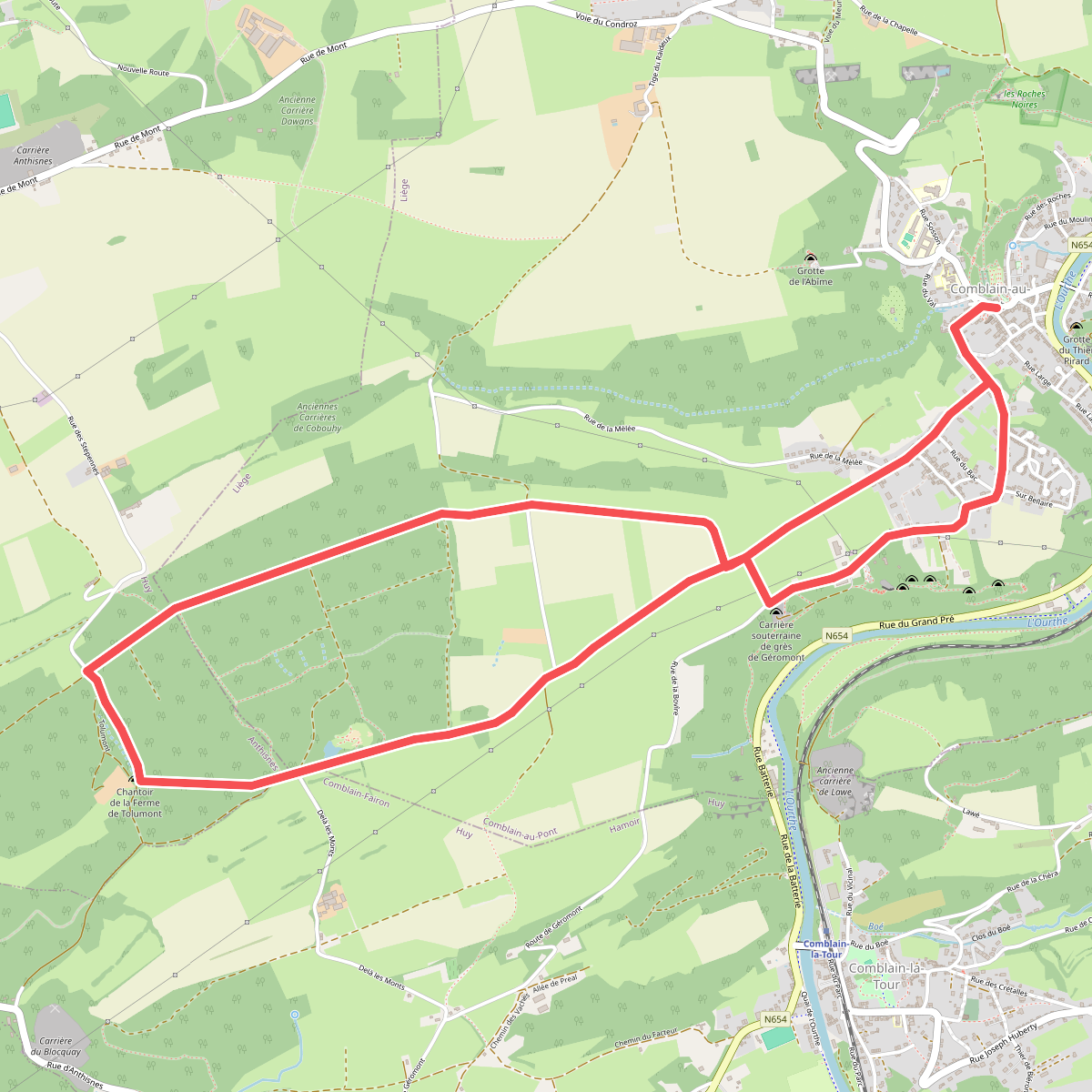
CB04 Géromont - Bois de Comblain - Géromont
Comblain-au-Pont,Anthisnes
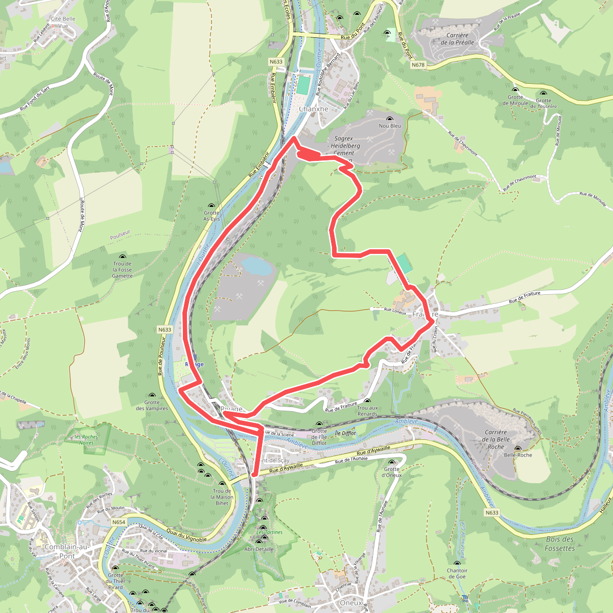
CB05 Pont-de-Sçay - Fraiture - Chanxhe
Comblain-au-Pont,Sprimont
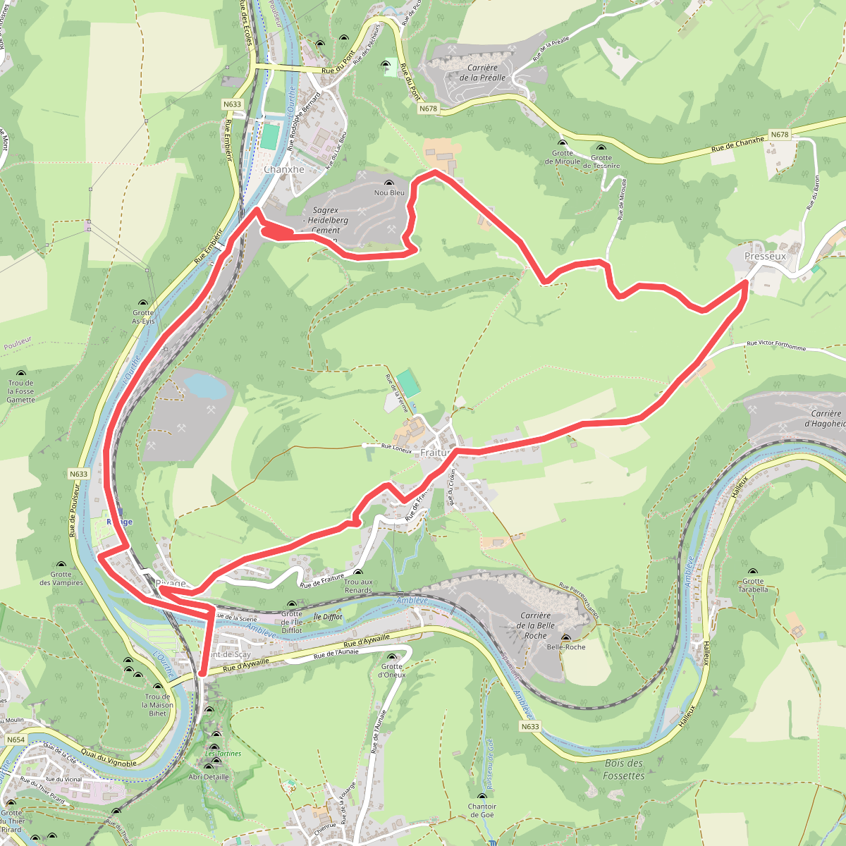
CB05 Pont-de-Sçay - Fraiture - Chanxhe (variante via Miroule)
Comblain-au-Pont,Sprimont
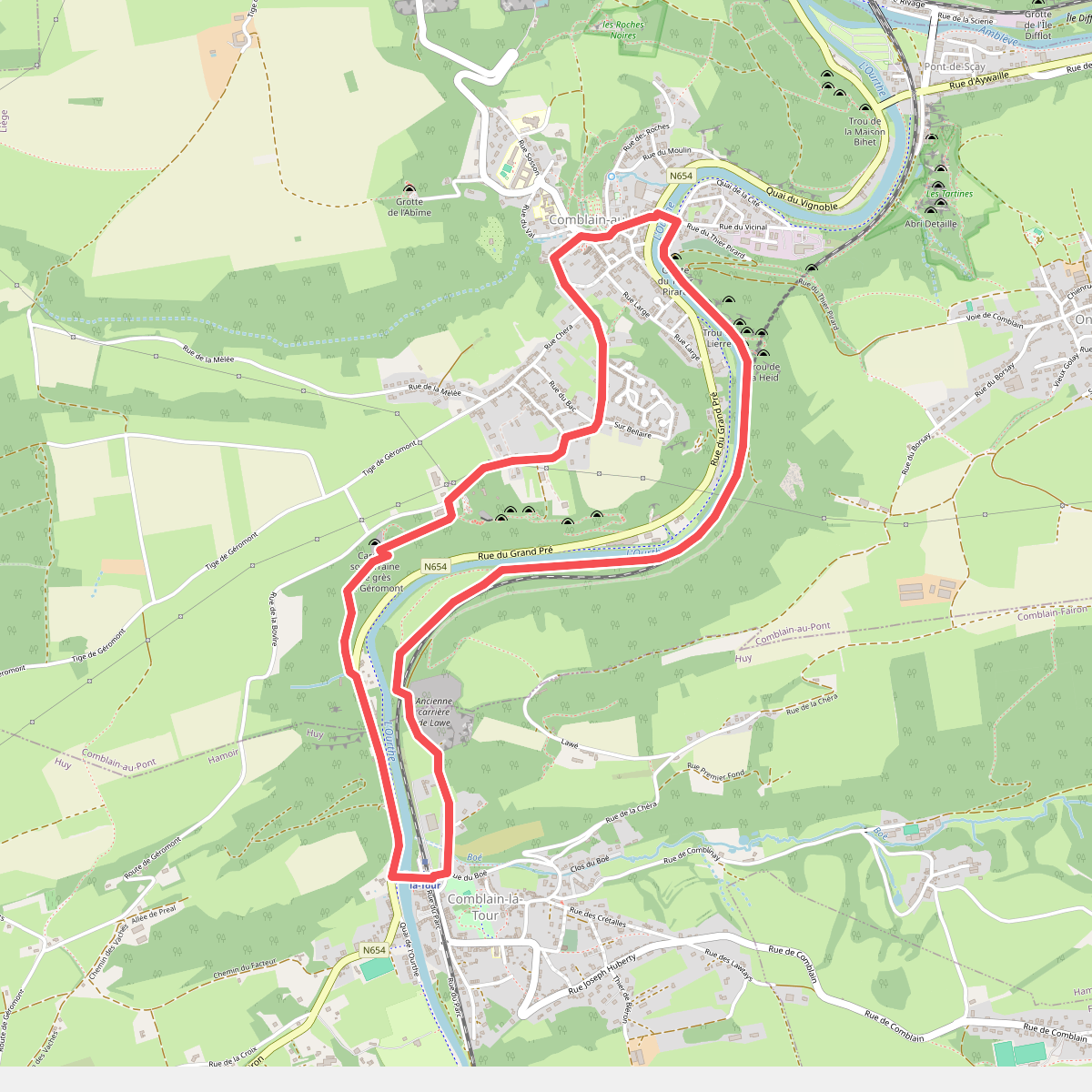
CB06 Comblain-au-Pont - Géromont - Comblain-la-Tour
Comblain-au-Pont,Hamoir
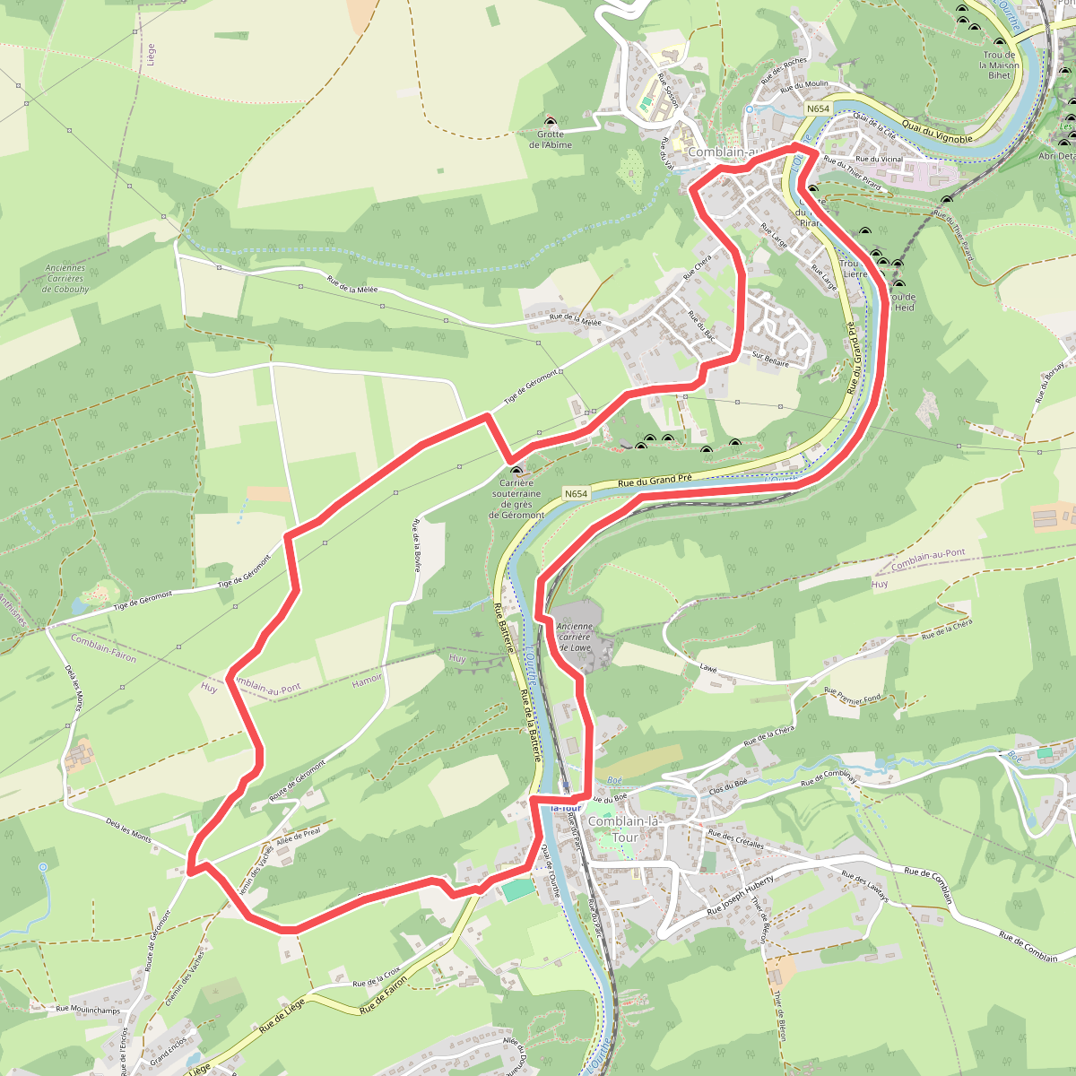
CB06 Comblain-au-Pont - Géromont - Comblain-la-Tour (variante via Au delà des Monts)
Comblain-au-Pont,Hamoir
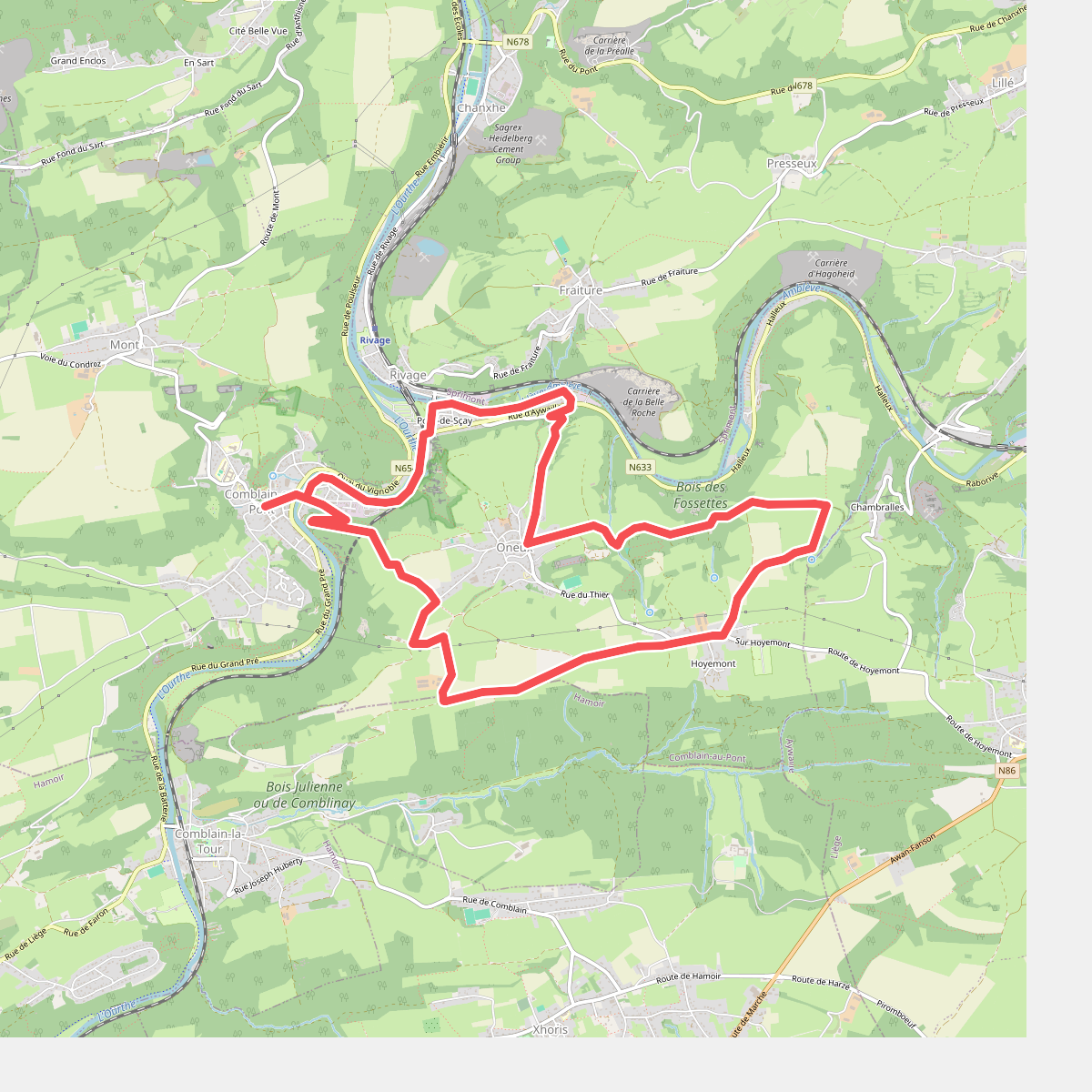
CB07 Comblain-au-Pont - Thier Pirard - Chambralles - Halleux
Comblain-au-Pont,Hamoir
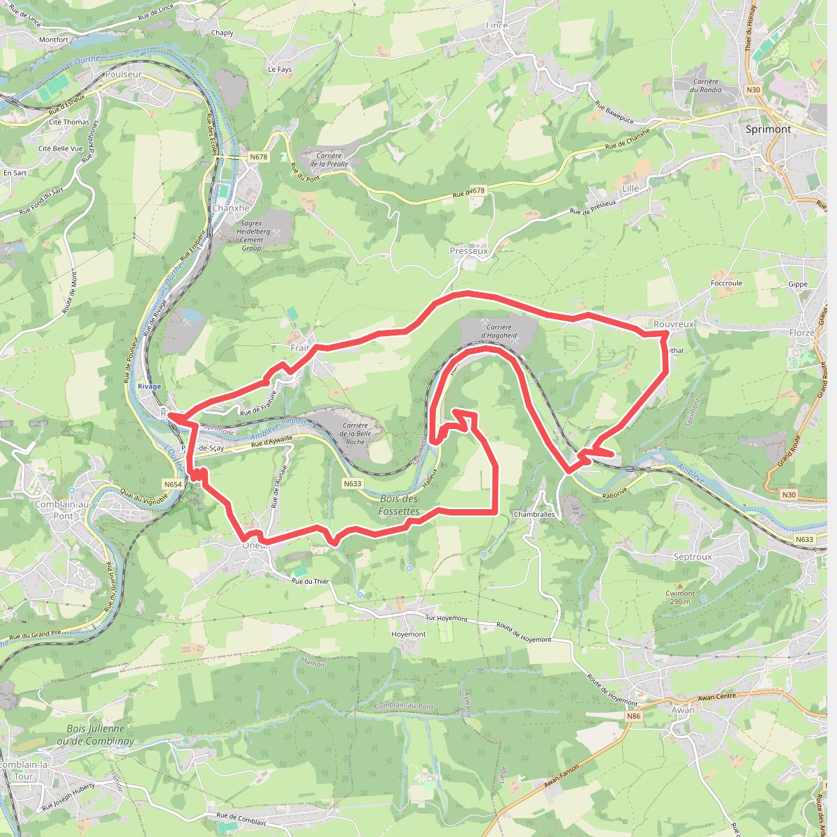
CB08 Fraiture - Rouvreux - Martinrive - Halleux - Oneux
Comblain-au-Pont,Sprimont,Rouvreux,Aywaille
🚀 Bekijk deze routes in de WandelWeb app!
Download de app voor kaarten, GPS navigatie en meer informatie over alle routes bij Comblain-au-Pont. Nooit meer de weg kwijt!