

The best hiking routes in Canton Esch-sur-Alzette
Discover the best walks in Canton Esch-sur-Alzette. 5 routes on the map, with descriptions, photos and GPX.
About Canton Esch-sur-Alzette
Canton Esch-sur-Alzette, located in the southern tip of Luxembourg, offers a walking landscape shaped entirely by its industrial past. This is not a region of deep, untouched forests or high mountain peaks, but rather a terrain of dramatic contrasts where nature has reclaimed abandoned open-cast iron mines. Walkers will notice the striking red soil underfoot, a direct result of the iron ore that once drove the local economy. The paths alternate between steep, wooded ravines and flat, exposed plateaus where the earth was once carved away.
Read more
About Canton Esch-sur-Alzette
Canton Esch-sur-Alzette, located in the southern tip of Luxembourg, offers a walking landscape shaped entirely by its industrial past. This is not a region of deep, untouched forests or high mountain peaks, but rather a terrain of dramatic contrasts where nature has reclaimed abandoned open-cast iron mines. Walkers will notice the striking red soil underfoot, a direct result of the iron ore that once drove the local economy. The paths alternate between steep, wooded ravines and flat, exposed plateaus where the earth was once carved away.
Read moreCanton Esch-sur-Alzette, located in the southern tip of Luxembourg, offers a walking landscape shaped entirely by its industrial past. This is not a region of deep, untouched forests or high mountain peaks, but rather a terrain of dramatic contrasts where nature has reclaimed abandoned open-cast iron mines. Walkers will notice the striking red soil underfoot, a direct result of the iron ore that once drove the local economy. The paths alternate between steep, wooded ravines and flat, exposed plateaus where the earth was once carved away.
Because there are no official nature parks in this canton, walkers must choose between two distinct landscape types. The first consists of the overgrown mining basins, where birch trees and dense scrub have colonized the red cliffs, creating a rugged, labyrinthine environment. The second type comprises the more traditional, gently rolling agricultural plateaus and beech forests that border the urban settlements. Here, the paths are wider and the terrain is much more predictable, though still marked by the occasional view of distant industrial infrastructure.
In late spring, particularly around May, the contrast is most visible as bright green foliage sprouts against the dark red earth of the old quarries. The ground underfoot varies from hard-packed clay to loose, stony tracks that can feel uneven. While the paths closer to the towns of Esch and Dudelange are popular with local walkers, the deeper sections of the former mining areas offer a quieter, more secluded atmosphere where the scale of the past industrial operations becomes truly apparent.
Zoom or pan for more routes
Hiking routes in Canton Esch-sur-Alzette (5)
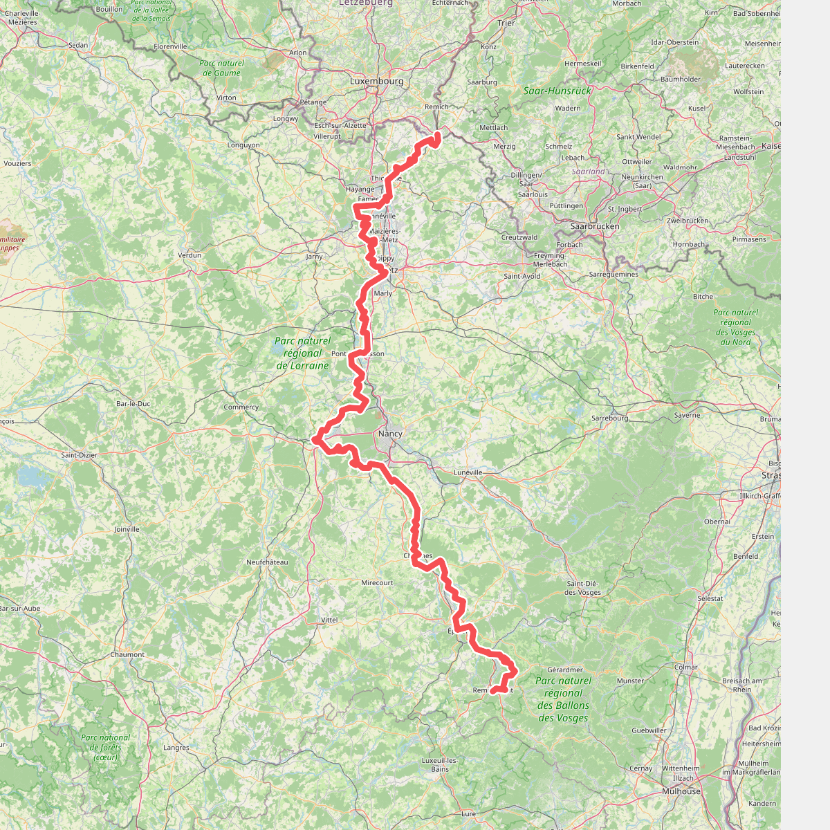
#1. Chemin de la Moselle
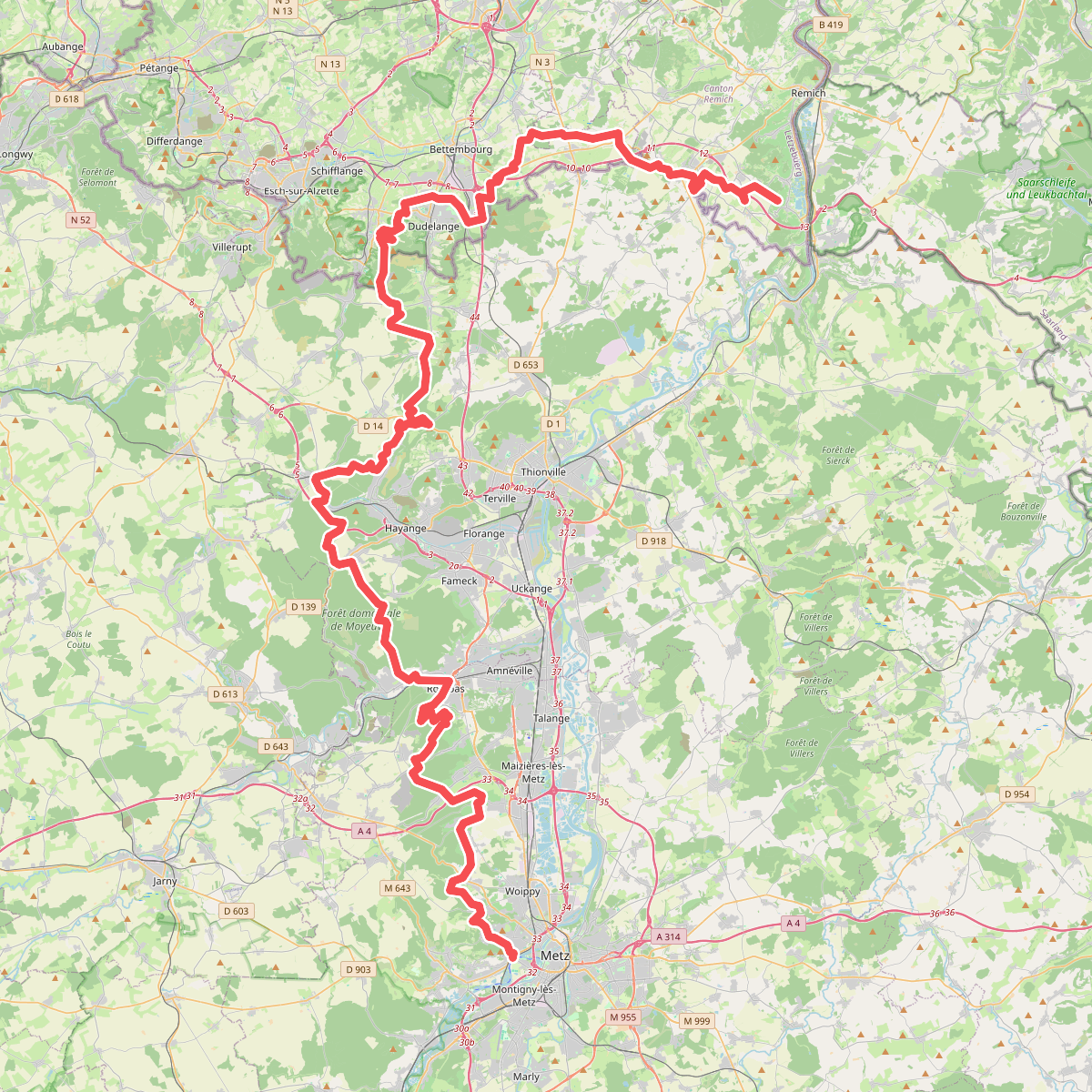
#2. GR 5
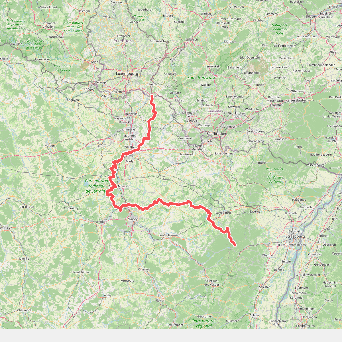
#3. GR 5 Lorraine
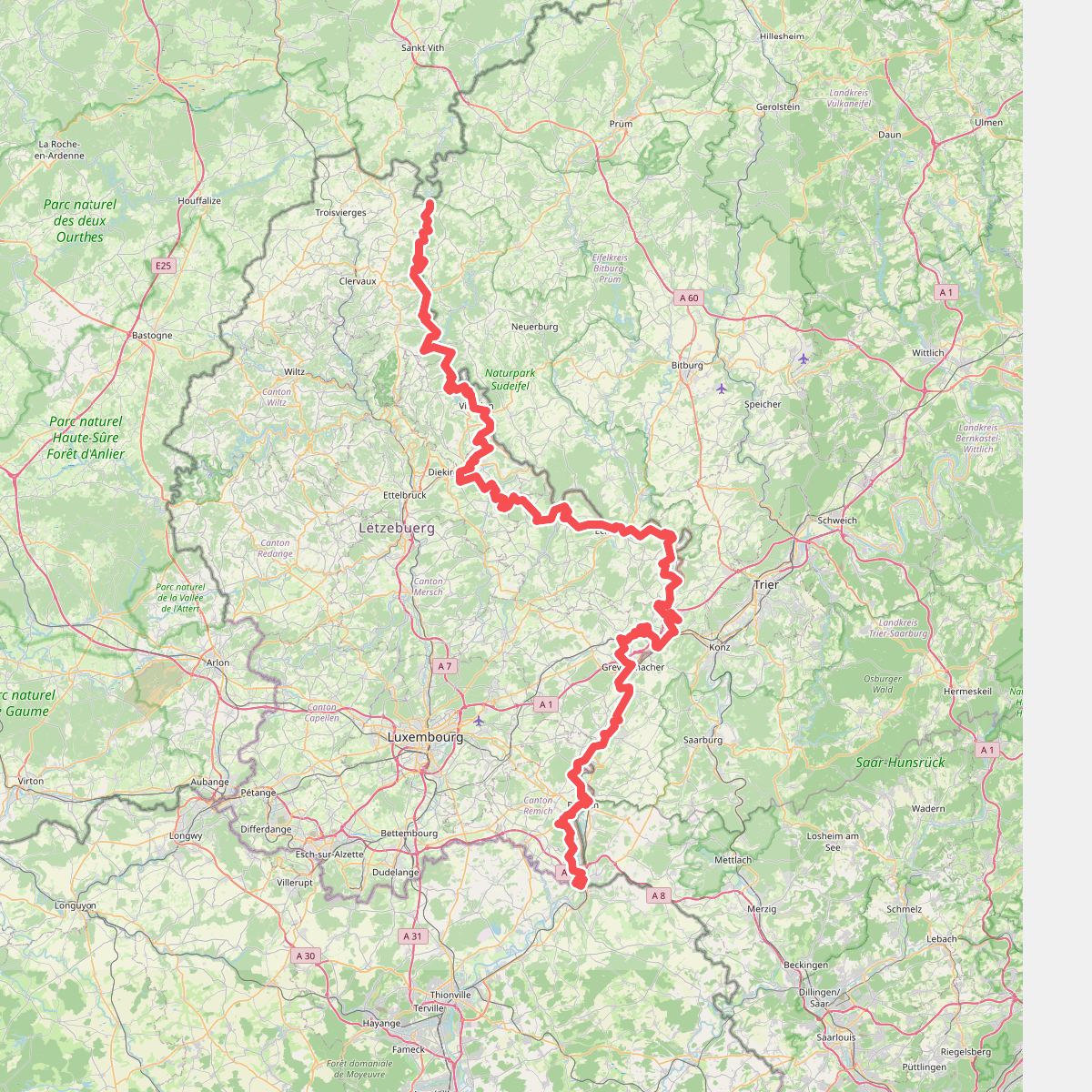
#4. GR 5 Luxembourg
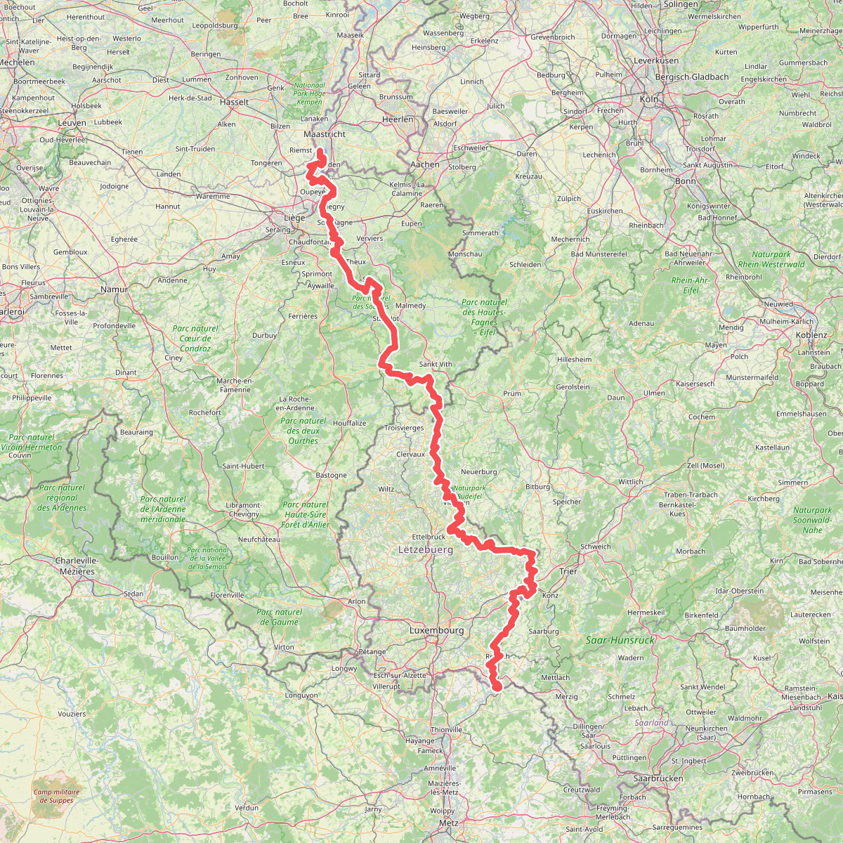
#5. Gr5 vanaf Maastricht
Riemst,Visé,Wonck,Haccourt,Feneur,Blegny,Soumagne,Olne,Trooz,Sprimont,Theux,Spa,La Gleize,Stavelot,Wanne,Vielsalm,Gouvy,Thommen,Reuland,Clervaux,Dasburg,Parc Hosingen,Putscheid,Vianden,Tandel,Bettendorf,Vallée de l'Ernz,Beaufort,Berdorf,Echternach,Rosport-Mompach,Condominium Lëtzebuerg-Deutschland,Mertert,Manternach,Wormeldange,Stadtbredimus,Remich,Schengen,Perl



