

The best hiking routes in Parc naturel de la Vallée de l'Attert
Discover the best walks in Parc naturel de la Vallée de l'Attert. 5 routes on the map, with descriptions, photos and GPX.
About Parc naturel de la Vallée de l'Attert
Parc naturel de la Vallée de l'Attert occupies a transitional landscape where the flat, clay-heavy soils of Belgian Lorraine meet the rising schistose slopes of the Ardennes foothills. Unlike the deep, rocky ravines found further north, this valley is defined by a wide, gently rolling depression carved by the Attert River. Walkers will notice a distinct contrast between the damp alluvial meadows along the riverbanks and the drier, marly ridges that border the valley. The underfoot conditions reflect this geology, shifting from soft, silty riverside paths to firmer clay and gravel tracks as you ascend the slopes.
Read more
About Parc naturel de la Vallée de l'Attert
Parc naturel de la Vallée de l'Attert occupies a transitional landscape where the flat, clay-heavy soils of Belgian Lorraine meet the rising schistose slopes of the Ardennes foothills. Unlike the deep, rocky ravines found further north, this valley is defined by a wide, gently rolling depression carved by the Attert River. Walkers will notice a distinct contrast between the damp alluvial meadows along the riverbanks and the drier, marly ridges that border the valley. The underfoot conditions reflect this geology, shifting from soft, silty riverside paths to firmer clay and gravel tracks as you ascend the slopes.
Read moreParc naturel de la Vallée de l'Attert occupies a transitional landscape where the flat, clay-heavy soils of Belgian Lorraine meet the rising schistose slopes of the Ardennes foothills. Unlike the deep, rocky ravines found further north, this valley is defined by a wide, gently rolling depression carved by the Attert River. Walkers will notice a distinct contrast between the damp alluvial meadows along the riverbanks and the drier, marly ridges that border the valley. The underfoot conditions reflect this geology, shifting from soft, silty riverside paths to firmer clay and gravel tracks as you ascend the slopes.
The landscape is heavily shaped by traditional agriculture, with a patchwork of hedgerows, damp grasslands, and small deciduous woodlots of oak and hornbeam. In May, the low-lying wet meadows are particularly distinct, filled with flowering marsh marigolds and bistort that thrive in the poorly drained clay soils. The paths here are mostly unpaved agricultural tracks and forest rides, which can feel heavy underfoot after sustained wet periods, requiring sturdy footwear rather than light trainers.
This area is suited for those who prefer quiet, rural walking through a working countryside rather than dramatic, craggy peaks or deep wilderness. The trails connect small, quiet villages built from local yellowish freestone, offering a steady, moderate gradient rather than steep climbs. It is a terrain of subtle transitions, where the main appeal lies in observing how the vegetation changes from water-loving willows in the valley bottom to beech forests on the higher, drier marl ridges.
Hiking routes in Parc naturel de la Vallée de l'Attert (5)
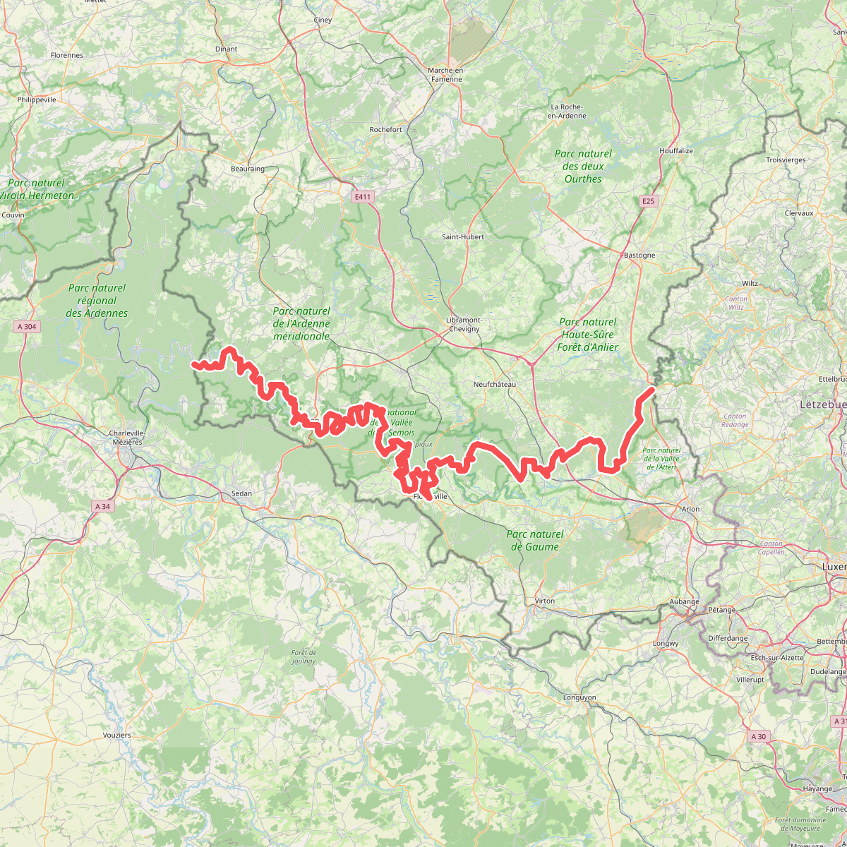
#1. European long distance path E3 - part Belgium
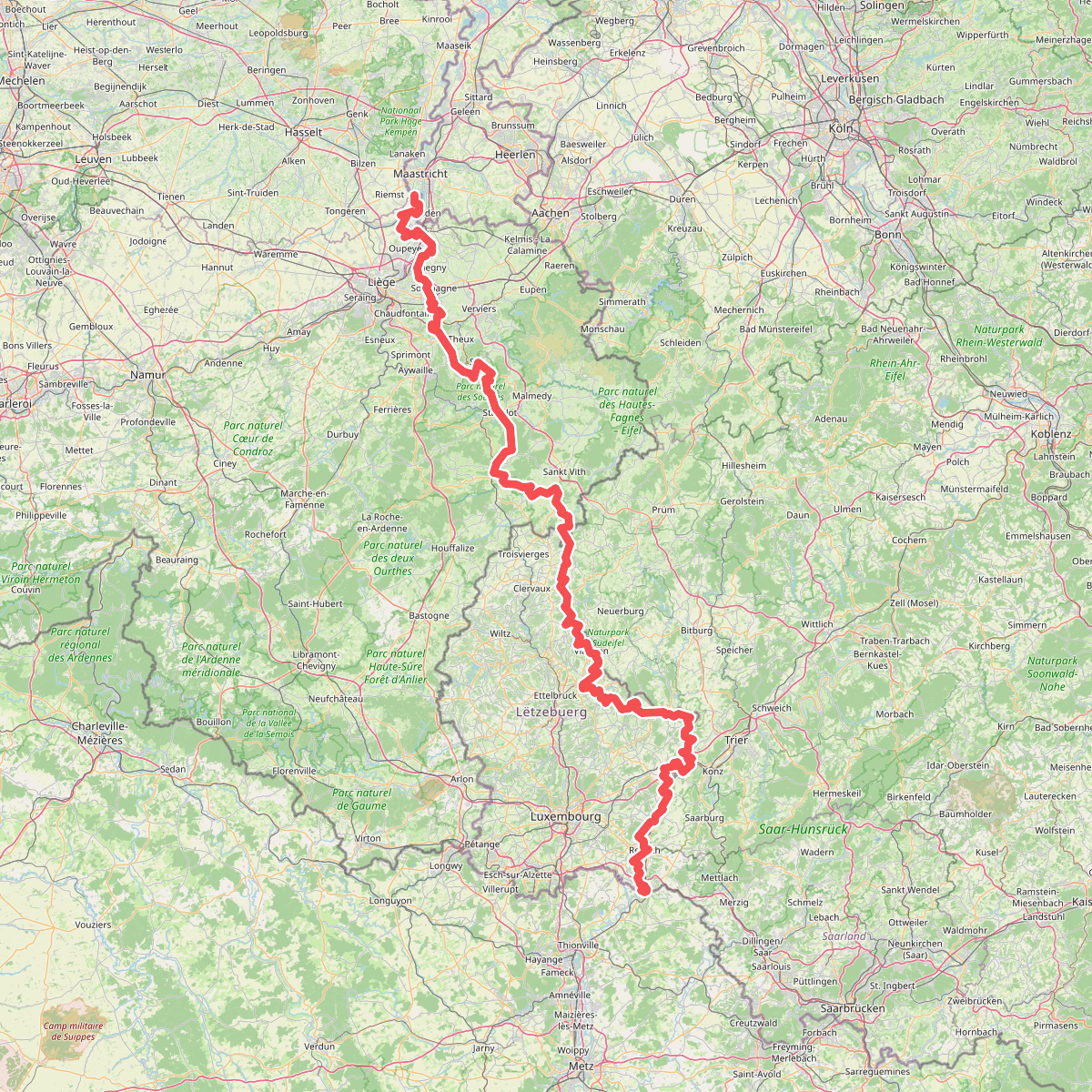
#2. Gr5 vanaf Maastricht
Riemst,Visé,Wonck,Haccourt,Feneur,Blegny,Soumagne,Olne,Trooz,Sprimont,Theux,Spa,La Gleize,Stavelot,Wanne,Vielsalm,Gouvy,Thommen,Reuland,Clervaux,Dasburg,Parc Hosingen,Putscheid,Vianden,Tandel,Bettendorf,Vallée de l'Ernz,Beaufort,Berdorf,Echternach,Rosport-Mompach,Condominium Lëtzebuerg-Deutschland,Mertert,Manternach,Wormeldange,Stadtbredimus,Remich,Schengen,Perl
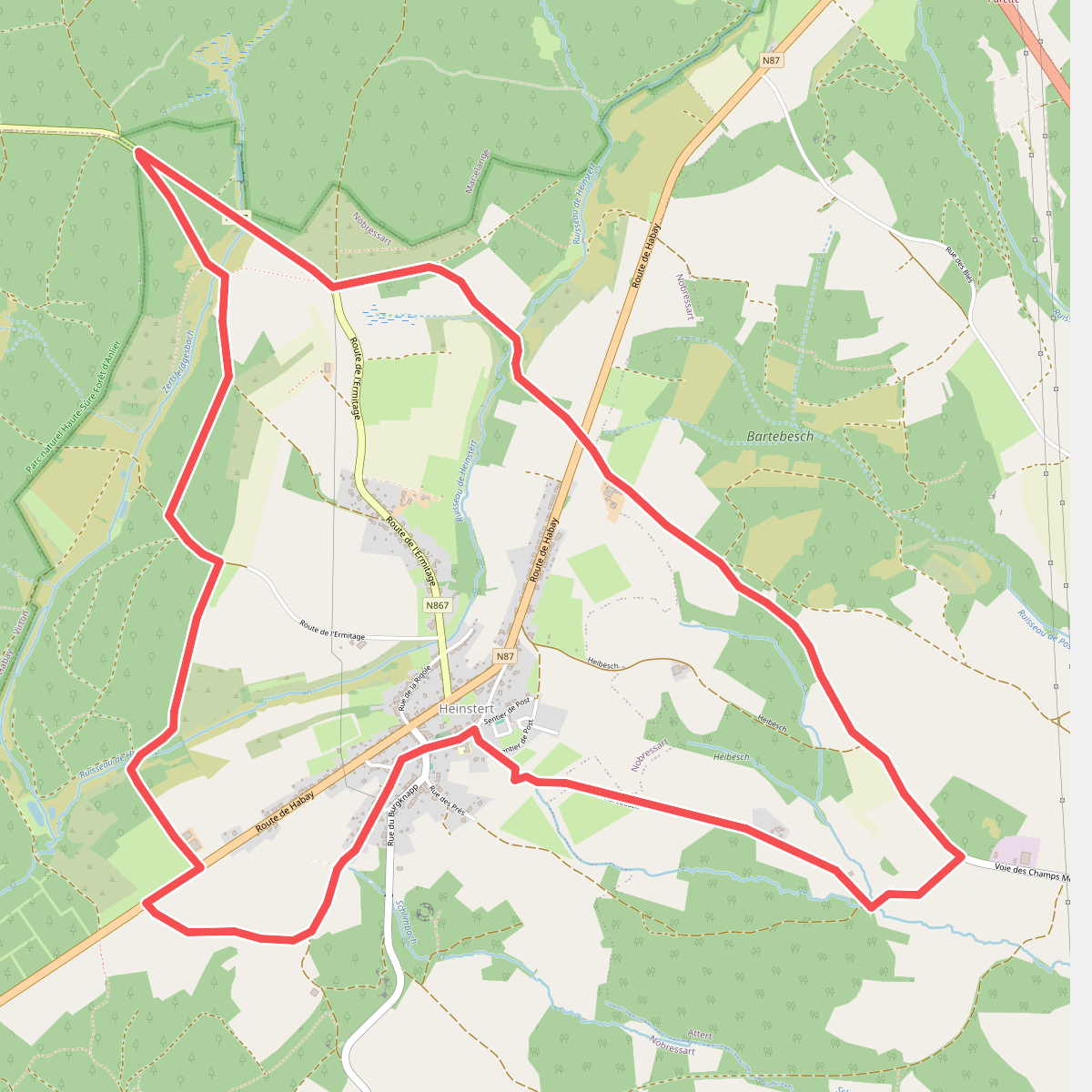
#3. Heinstert - aux portes de la Forêt d'Anlier
Nobressart,Attert
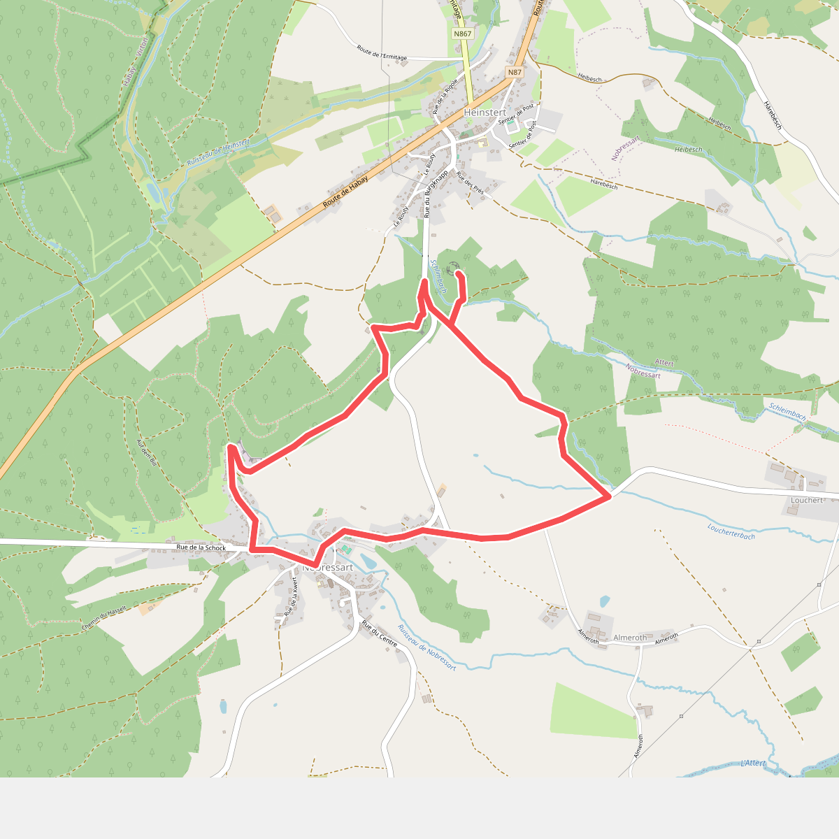
#4. Nobressart
Nobressart
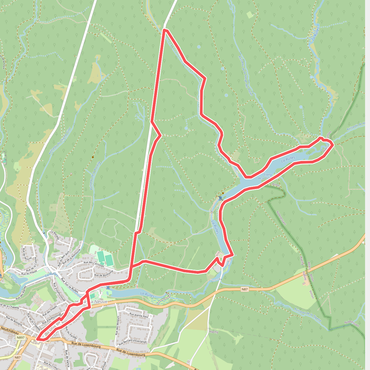
#5. Promenade de la Fagne Jean Simon
Habay-la-Neuve,Nobressart



