

The best hiking routes in Park Krajobrazowy Doliny Bobru
Discover the best walks in Park Krajobrazowy Doliny Bobru. 5 routes on the map, with descriptions, photos and GPX.
About Park Krajobrazowy Doliny Bobru
Park Krajobrazowy Doliny Bobru is defined by the steep, wooded slopes of the Bóbr River valley and the dramatic, rocky outcrops that line its banks. Unlike the flat plains further north, this landscape is characterized by deep river cuts, forested hillsides, and exposed granite and sandstone formations. Walkers will find a mix of damp riverside paths and steep, stony climbs that lead up to panoramic viewpoints over the water. The area is not a high mountain range, but the constant elevation changes require steady footing.
Read more
About Park Krajobrazowy Doliny Bobru
Park Krajobrazowy Doliny Bobru is defined by the steep, wooded slopes of the Bóbr River valley and the dramatic, rocky outcrops that line its banks. Unlike the flat plains further north, this landscape is characterized by deep river cuts, forested hillsides, and exposed granite and sandstone formations. Walkers will find a mix of damp riverside paths and steep, stony climbs that lead up to panoramic viewpoints over the water. The area is not a high mountain range, but the constant elevation changes require steady footing.
Read morePark Krajobrazowy Doliny Bobru is defined by the steep, wooded slopes of the Bóbr River valley and the dramatic, rocky outcrops that line its banks. Unlike the flat plains further north, this landscape is characterized by deep river cuts, forested hillsides, and exposed granite and sandstone formations. Walkers will find a mix of damp riverside paths and steep, stony climbs that lead up to panoramic viewpoints over the water. The area is not a high mountain range, but the constant elevation changes require steady footing.
Underfoot, the trails vary from soft, leaf-strewn forest tracks to rugged, rocky paths where tree roots and stones require careful attention. Along the river, the terrain is flatter and dominated by alluvial forests, while the higher ridges feature dry pine and mixed woodland. You will notice several historic stone dams and footbridges crossing the river, which have altered the natural flow and created wide, reservoir-like sections of water contrasting with the faster, shallower rapids.
In October, the beech and oak forests on the valley slopes turn deep shades of yellow and orange, making the geology of the cliffs more visible through the thinning canopy. The popular viewpoints near Pilchowice can be busier on autumn weekends, but the longer paths winding through the side valleys remain quiet. This park is best suited for those who enjoy river scenery and moderate hill walking rather than high-altitude trekking.
Hiking routes in Park Krajobrazowy Doliny Bobru (5)
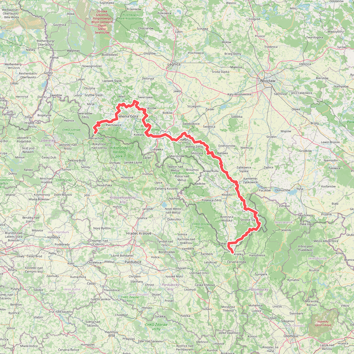
#1. European long distance path E3 - part Poland (west)
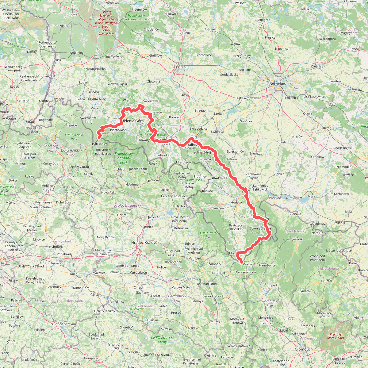
#2. Internationaler Bergwanderweg Eisenach–Budapest (Polen West)
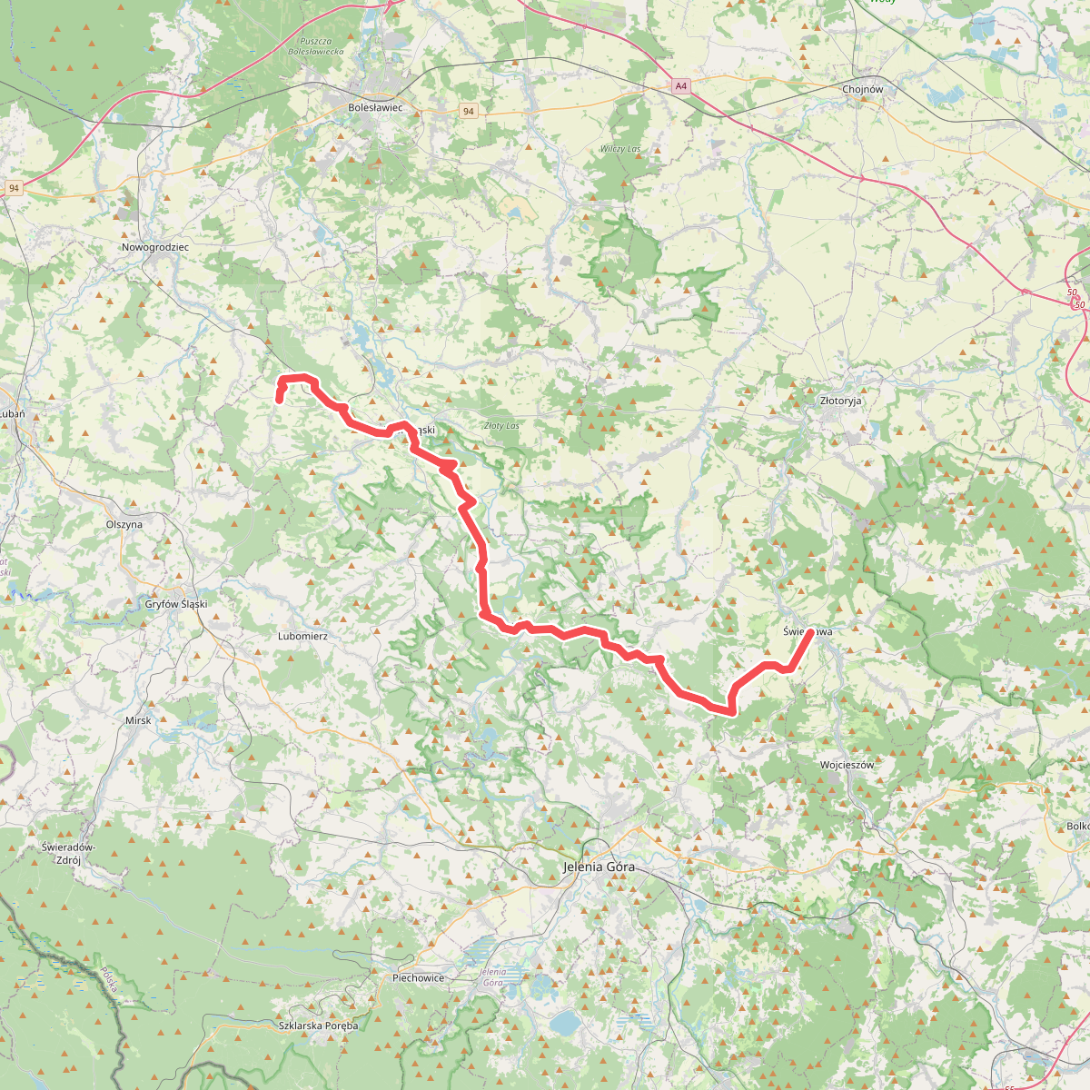
#3. Niwnice-Świerzawa
Niwnice,Radłówka,Lwówek Śląski,Dębowy Gaj,Mojesz,Marczów,Łupki,Wleń,Tarczyn,Rząśnik,Janówek,Chrośnica,Lubiechowa,Stara Kraśnica,Świerzawa
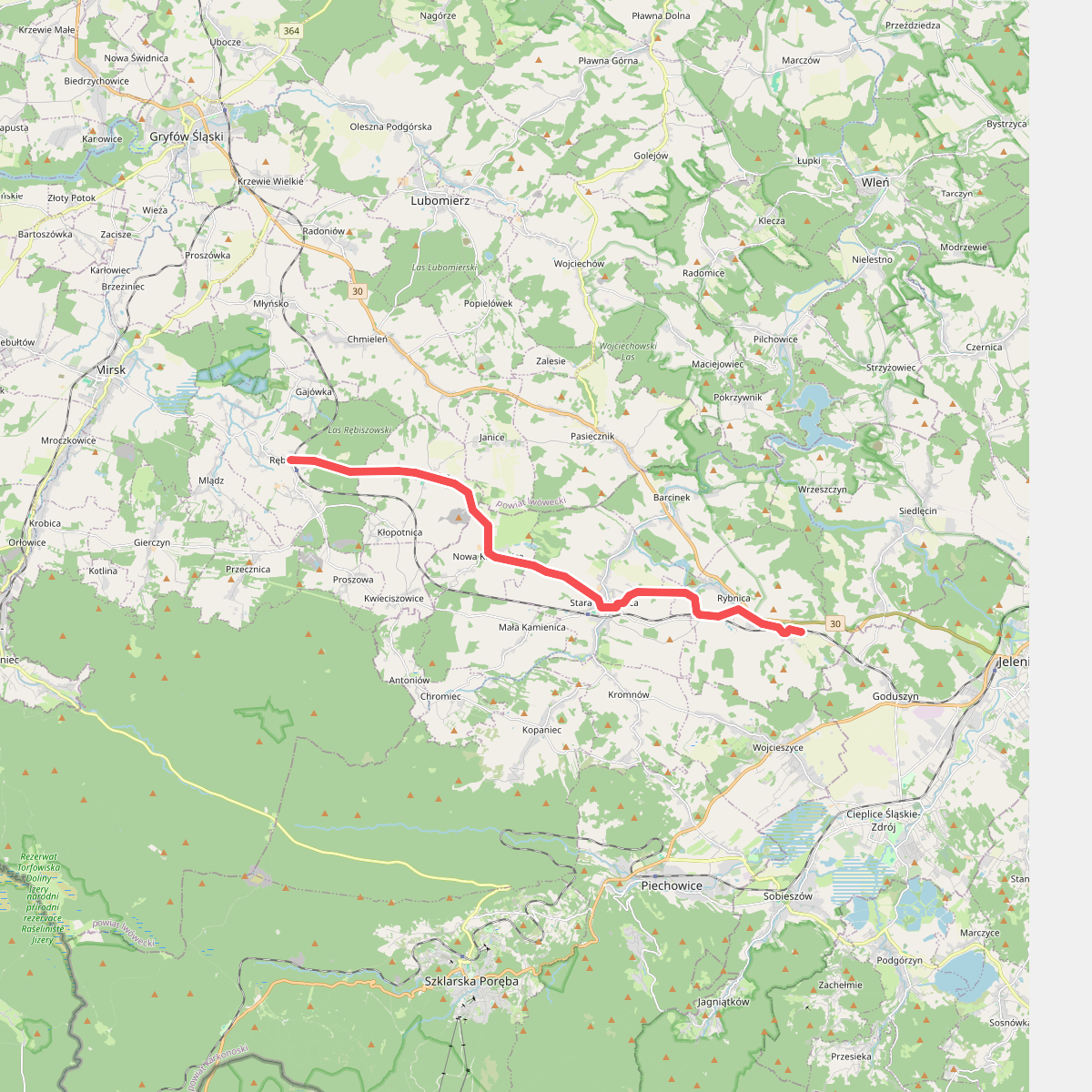
#4. Rębiszów - Rybnica
Rębiszów,Grudza,Nowa Kamienica,Stara Kamienica,Rybnica
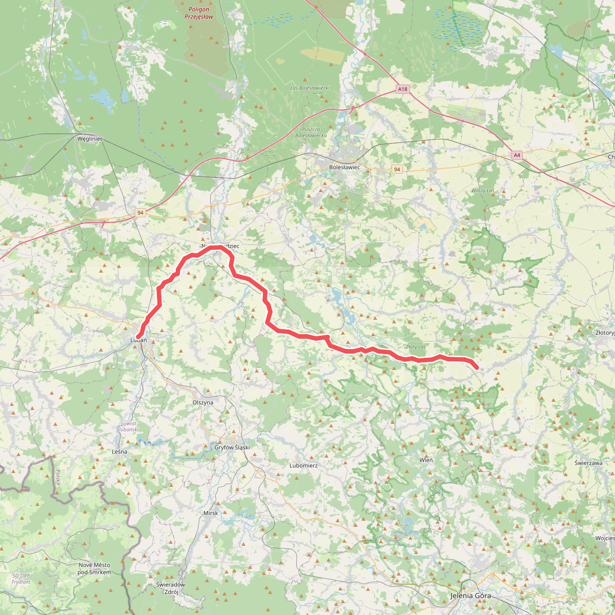
#5. Sudecka Droga św. Jakuba
Twardocice,Bielanka,Dłużec,Pieszków,Sobota,Dworek,Lwówek Śląski,Radłówka,Niwnice,Gościszów,Milików,Nowogrodziec,Nawojów Łużycki,Radogoszcz,Lubań



