

The best hiking routes in Isle of Wight National Landscape
Discover the best walks in Isle of Wight National Landscape. 3 routes on the map, with descriptions, photos and GPX.
About Isle of Wight National Landscape
The Isle of Wight National Landscape covers about half of the island, split into distinct, disconnected sections rather than a single continuous park. Walkers will find a landscape defined by its geology, most notably the high chalk ridge that runs from east to west, ending in the sea stacks of The Needles. South of this ridge lies a contrasting depression of soft greensand and clay, which creates a gentler, rolling agricultural landscape cut by deep, wooded chines that lead down to the coast. You will not find high mountain peaks or vast wilderness areas here, but rather a dense network of paths crossing managed farmland, downs, and tidal estuaries.
Read more
About Isle of Wight National Landscape
The Isle of Wight National Landscape covers about half of the island, split into distinct, disconnected sections rather than a single continuous park. Walkers will find a landscape defined by its geology, most notably the high chalk ridge that runs from east to west, ending in the sea stacks of The Needles. South of this ridge lies a contrasting depression of soft greensand and clay, which creates a gentler, rolling agricultural landscape cut by deep, wooded chines that lead down to the coast. You will not find high mountain peaks or vast wilderness areas here, but rather a dense network of paths crossing managed farmland, downs, and tidal estuaries.
Read moreThe Isle of Wight National Landscape covers about half of the island, split into distinct, disconnected sections rather than a single continuous park. Walkers will find a landscape defined by its geology, most notably the high chalk ridge that runs from east to west, ending in the sea stacks of The Needles. South of this ridge lies a contrasting depression of soft greensand and clay, which creates a gentler, rolling agricultural landscape cut by deep, wooded chines that lead down to the coast. You will not find high mountain peaks or vast wilderness areas here, but rather a dense network of paths crossing managed farmland, downs, and tidal estuaries.
Underfoot, the terrain changes quickly depending on the geology. Walking along the downs means following short-turf grass paths over hard, well-drained chalk, which can be slippery when wet. In contrast, the lower-lying paths in the Yar and Medina valleys often cross damp clay soils and marshy meadows, where wooden boardwalks are occasionally provided to help cross the wettest sections. Coastal paths range from gravelly tracks along the cliff edges to sandy stretches near the beaches, with some sections subject to diversion due to active coastal erosion.
In May, the ancient woodlands of the northern clay pastures, such as those near Bouldnor, are filled with flowering bluebells, while the open chalk grasslands of Tennyson Down show their first flush of wildflowers. The busier coastal paths near popular seaside towns contrast with the quieter inland paths through the sandstone hills, where walkers are more likely to encounter livestock than crowds. This variety makes the area suitable for those who enjoy changing scenery over short distances, moving from exposed cliff tops to sheltered river valleys within a few miles.
Hiking routes in Isle of Wight National Landscape (3)
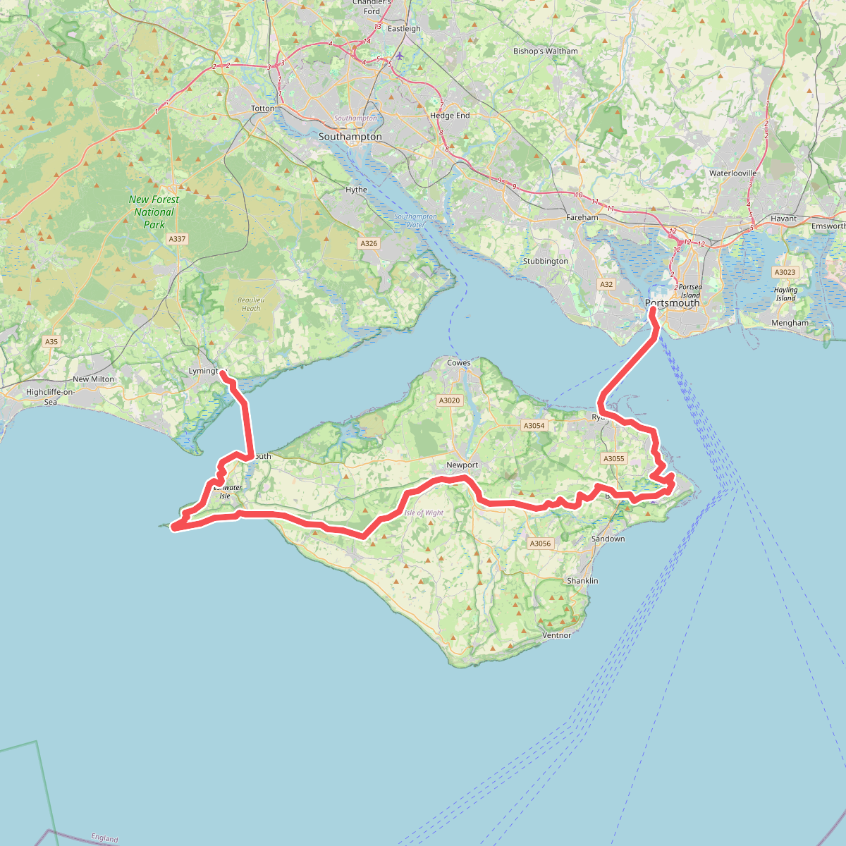
#1. European walking route E9, Isle of Wight alternative
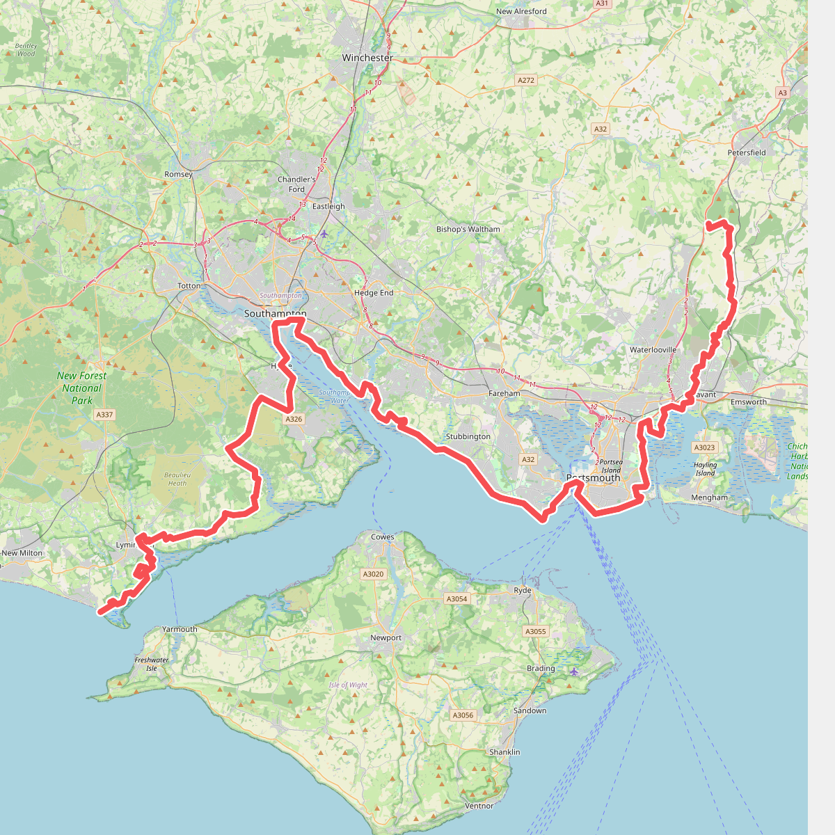
#2. European walking route E9, Milford on Sea to Queen Elizabeth Country Park
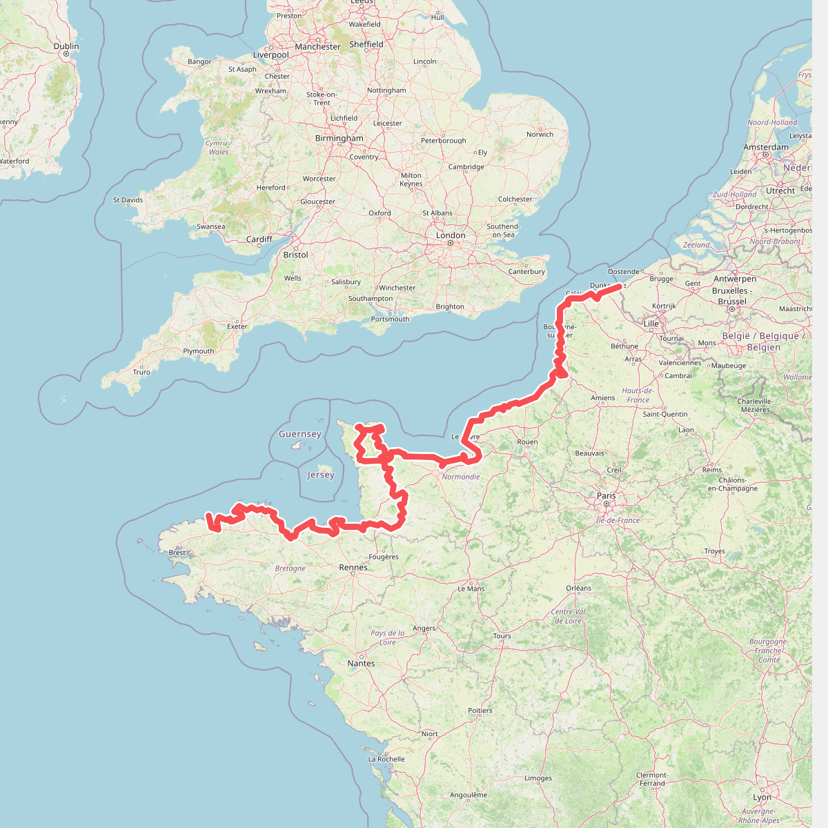
#3. Eurovelo 4
Roscoff,Saint-Pol-de-Léon,Plouénan,Taulé,Saint-Martin-des-Champs,Morlaix,Plouezoc'h,Plougasnou,Saint-Jean-du-Doigt,Guimaëc,Locquirec,Plestin-les-Grèves,Saint-Michel-en-Grève,Ploumilliau,Ploubezre,Lannion,Trébeurden,Pleumeur-Bodou,Trégastel,Perros-Guirec,Louannec,Camlez,Penvénan,Plouguiel,Trédarzec,Pleumeur-Gautier,Lézardrieux,Paimpol,Plouézec,Plouha,Tréveneuc,Binic-Étables-sur-Mer,Pordic,Plérin,Saint-Brieuc,Langueux,Hillion,Lamballe-Armor,Pléneuf-Val-André,Erquy,Fréhel,Plévenon,Pléboulle,Matignon,Saint-Cast-le-Guildo,Beaussais-sur-Mer,Tréméreuc,Plouër-sur-Rance,Saint-Suliac,Saint-Père-Marc-en-Poulet,Saint-Malo,Saint-Coulomb,Cancale,Saint-Méloir-des-Ondes,Hirel,Cherrueix,France métropolitaine,Roz-sur-Couesnon,Pontorson,Courtils,Céaux,Poilley,Ducey-les-Chéris,Isigny-le-Buat,Grandparigny,Romagny Fontenay,Saint-Clément-Rancoudray,Sourdeval,Vire Normandie,Souleuvre-en-Bocage,Pont-Bellanger,Tessy-Bocage,Fourneaux,Condé-sur-Vire,Bourgvallées,Saint-Lô,Agneaux,Pont-Hébert,Airel



